PUBLISHER
|
YEAR
|
MAP TEXT
|
Bertelli (Ferrando)

Map of Cyprus
(728'455 bytes) |
1562
|
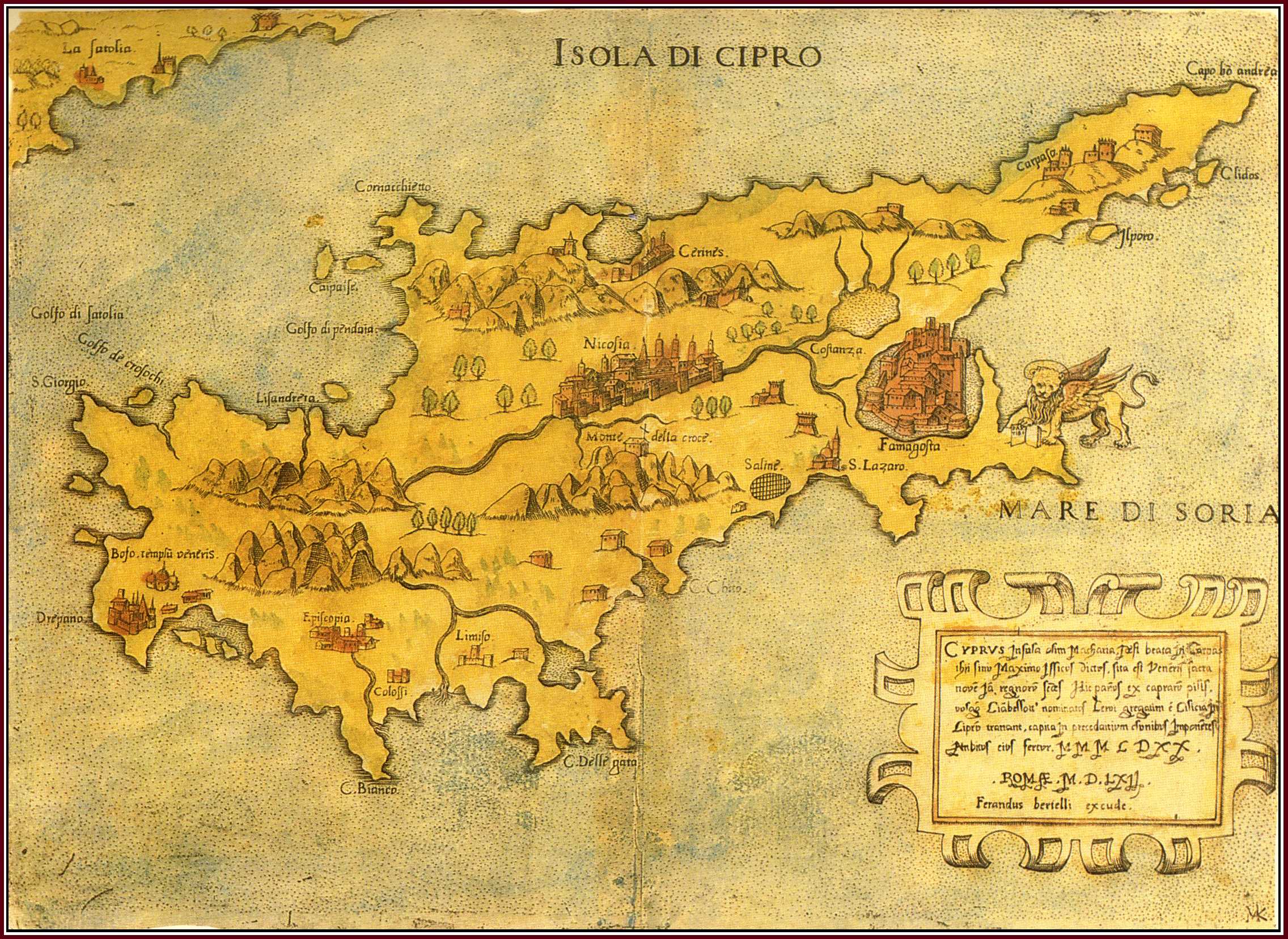
Ferrandus BERTELLI , " Isola di Cipro " - " Cyprus Insula olim Macharia... Romae M.D.LXII , Ferandus Bertelli excude " (182x250mm) , Rome 1562 . Loose sheet . Contemporary colour .
This very rare map of Cyprus was first issued in Rome in 1560 by a certain "B.F." The Venetian , F. Bertelli published the same map two years later , in 1562 , after it had been re-engraved by the Roman cartographer Marius Kartaro whose monogram , "M.K.", appears at the bottom right corner . It is a loose sheet map but it has also been traced in Lafreri type atlases (IATO collections) . The present copy was once in the famous Novacco Map Collection . Although published in the 1560s , when such Venetian cartographers like Camocio were at work (see Fig. 7) , this map is more akin to Bordone's woodcut style of the 1520s (see Fig. 2) and uses mostly pictorial signs rather than toponyms .
|
Xylander, Gulielmus
Map of Cyprus
(601'186 bytes) |
1571
|
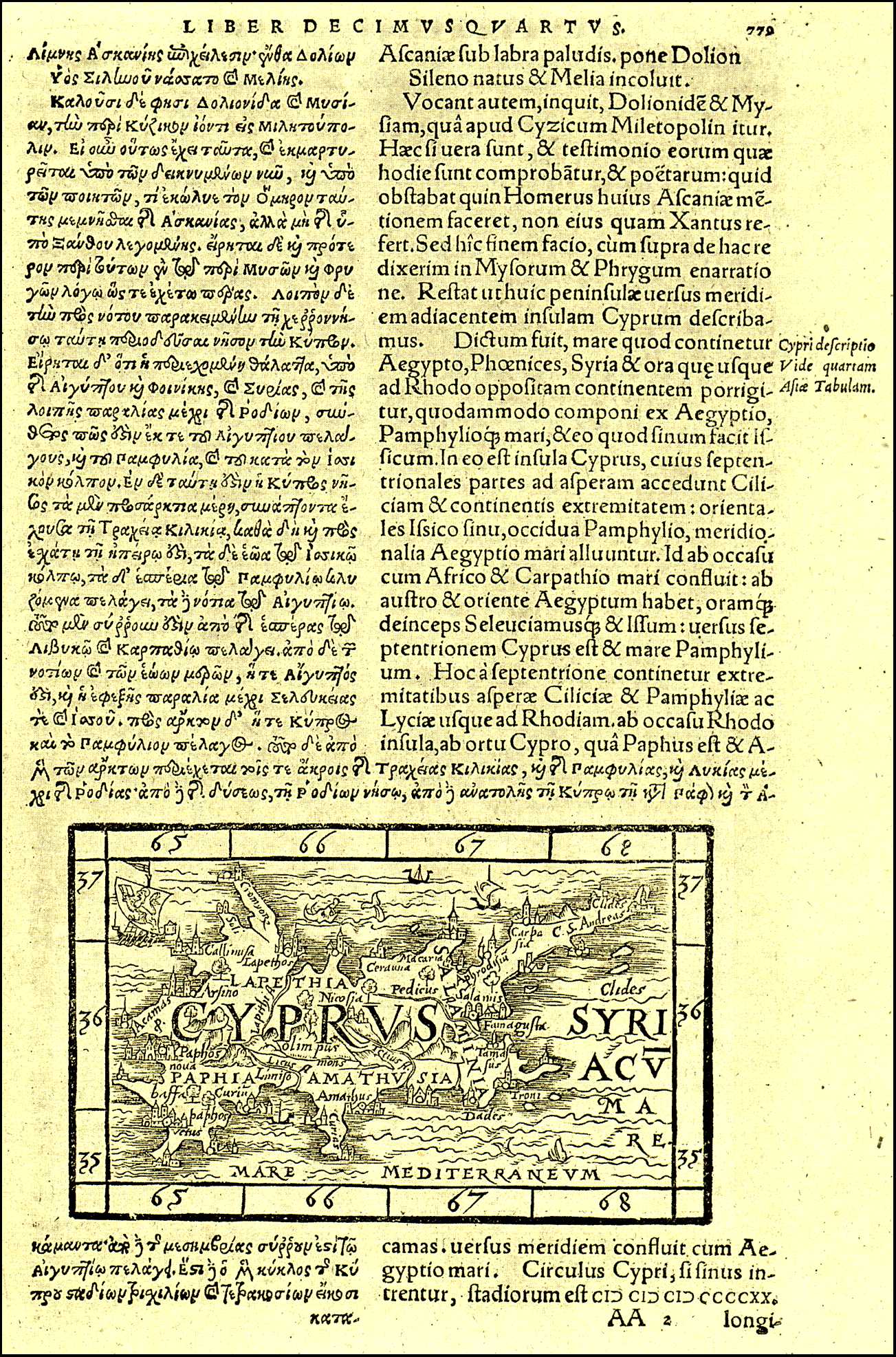
Gulielmo XYLANDRO , "Cyprus" , woodcut (75x120mm) page 779 , Basle 1571
The small woodcut map originated in 1561 in Ioannis Honterus' Cosmographia published in Basle by Henricus Petri . A decade later Petri published G. Xylandro's edition of Srabo's geographical work and the same small map of Cyprus was republished along with five other woodcuts of Greek islands .
The map is wholly based on Ptolemy's map of the island . It is printed at the lower part of page 779 where the text on Cyprus begins set in two columns : Greek on one and Latin translation on the other . The contents of the map are ancient but the three main medieval towns of Nicosia , Famagusta and Limassol are also indicated .
|
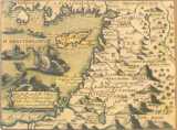
Ortelius, Abraham
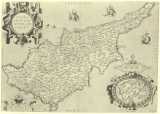
(Map of Cyprus
728'455 bytes) |
1574
|
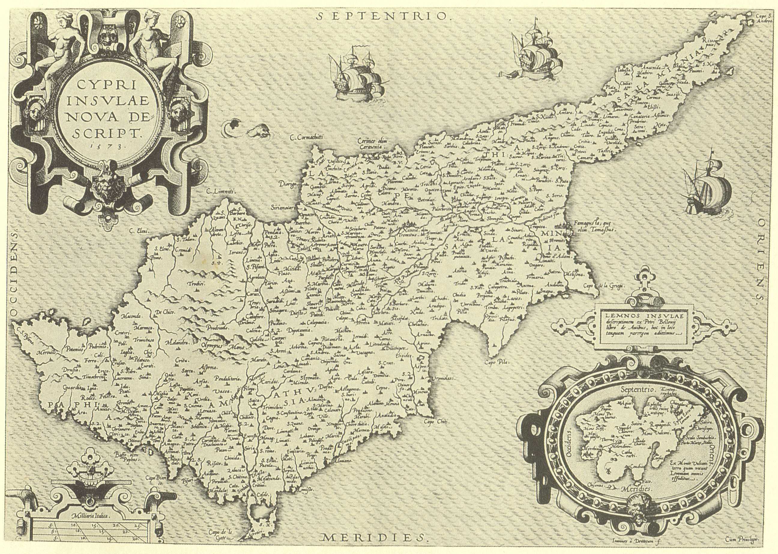
Abraham ORTELIUS (publisher) , Ioannes a DEUTECUM (engraver) , "Cypri Insulae Nova Descript . 1573 ." (350x495mm) page 52 , Theatrum Orbis Terrarum , Antwerp 1574 . Latin .
The first edition of Ortelius' Theatrum (Antwerp 1570) included an old-type map of the island (see Fig.88). In 1573 , in Additamentum I , Ortelius introduced a new map of Cyprus coupled with Lemnos inside a cartouche . His prototype was an extremely rare map of Cyprus by Jacomo Franco published in Venice in 1570 . Franco's map offered the latest correct data concerning Cyprus at that troubled period . Strangely , Franco did not make further use of his map . Thus , Ortelius' map of 1573 became the most advanced and correct prototype , destined to be used by cartographers and publishers throughout Europe until the middle of the 18th. century . The text at the back was periodically up-dated by Ortelius while his engravers conditioned the printing plate since the map was published in all the subsequent editions of the Theatrum in various languages .
|
Ortelius, Abraham
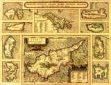
Map of Cyprus
(1'086'246 bytes) |
1584
|
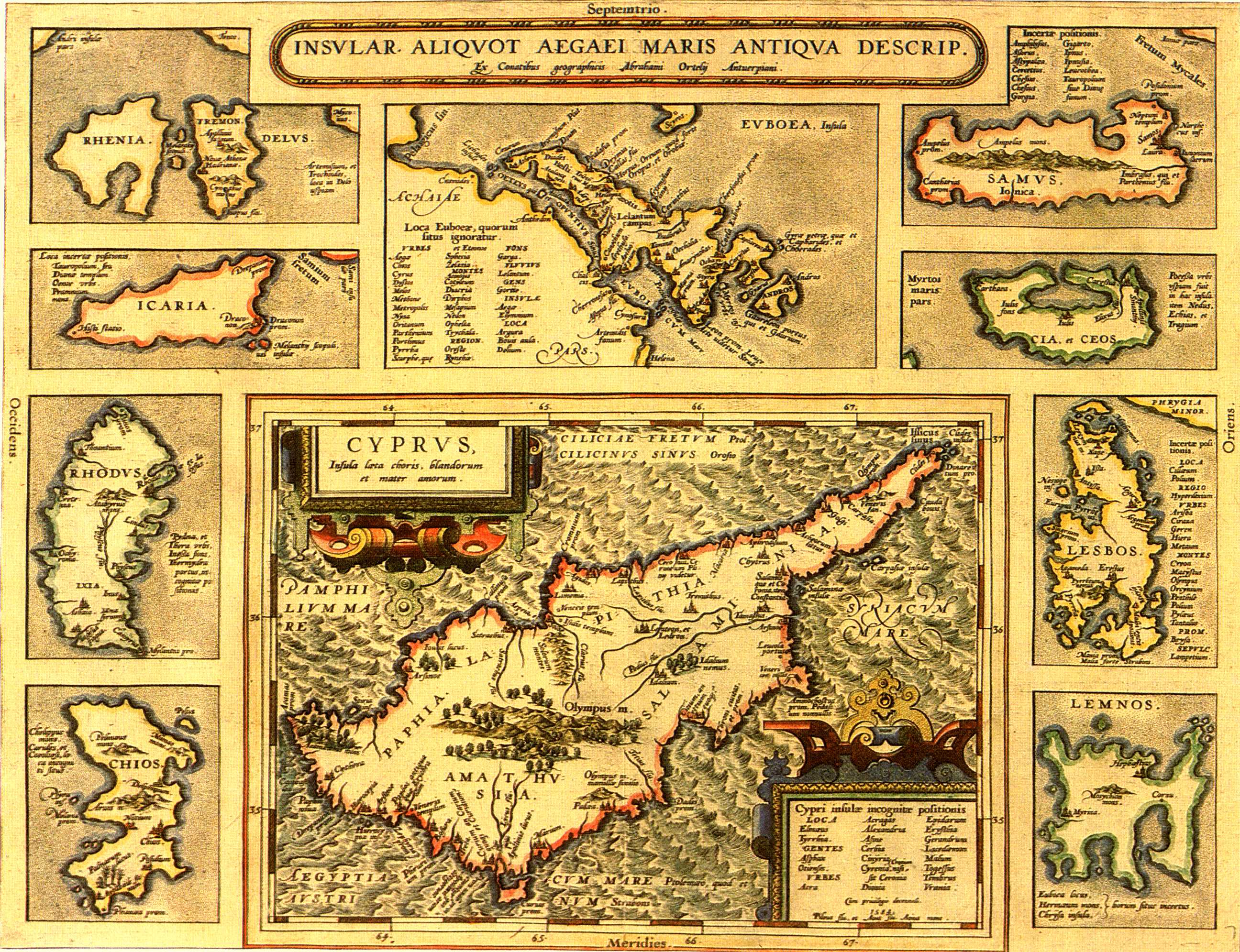
Abraham ORTELIUS , "Insular . Aliquot Aegaei Maris Antiqua Descrip . "-"Cyprus Insula laeta choris ,..."(360x470mm) page 90 , Theatrum Orbis Terrarum , Antwerp 1584 . Latin . Coloured .
Drawn by Ortelius himself , this map is a reduced version of the map (Fig. 10) and shows Cyprus with nine insets of other Greek islands . It was first published by Ortelius in Additamentum III and as of 1584 it was included in the Parergon , a supplement to the Theatrum . The map contains ancient toponyms . The present edition comes from the original of 1584 (see also Fig. 11 of 1608 after the place name "Amathus" was added on Cyprus (1587) and "Melanthy Scopuli" deleted from the Greek islands (ca 1600).
|
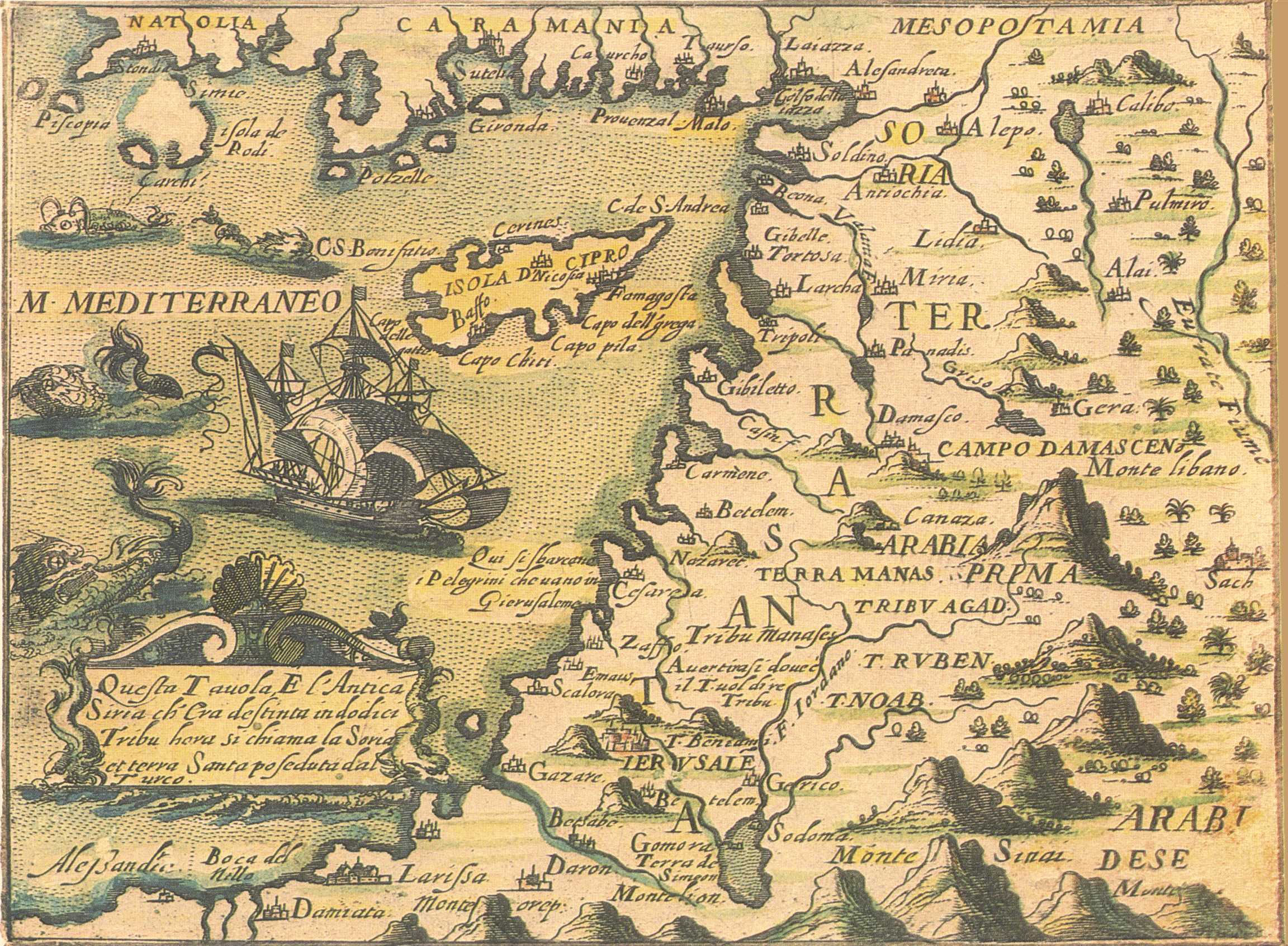
Rosaccio, Gioseppe and Franco, Giacomo
Map of Levant
(697'874 bytes) |
1598
|
Gioseppe ROSACCIO(author) , Jacomo FRANCO(engraver) ,"Isola D Cipro" - "Natolia..." (143x192mm) , Viaggio Da Venetia A Constantinopoli..., Venice 1598 or later . Coloured .
Map of the Levant , engraved by Jacomo Franco . Number"82" written in manuscript ink appears on top right corner . The same map is found among the 75 maps and plans in entry(18) , the Viaggio . It is not known from which edition of the Viaggio the present map comes . The Viaggio was first published in 1598 with Rosaccio's text but there were various other editions with , or without text , in the 17th. century .
|