PUBLISHER
|
YEAR
|
MAP TEXT
|
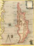
Dapper, Olfert (Olivier)
Map of Cyprus
(898'682 bytes) |
1703
|
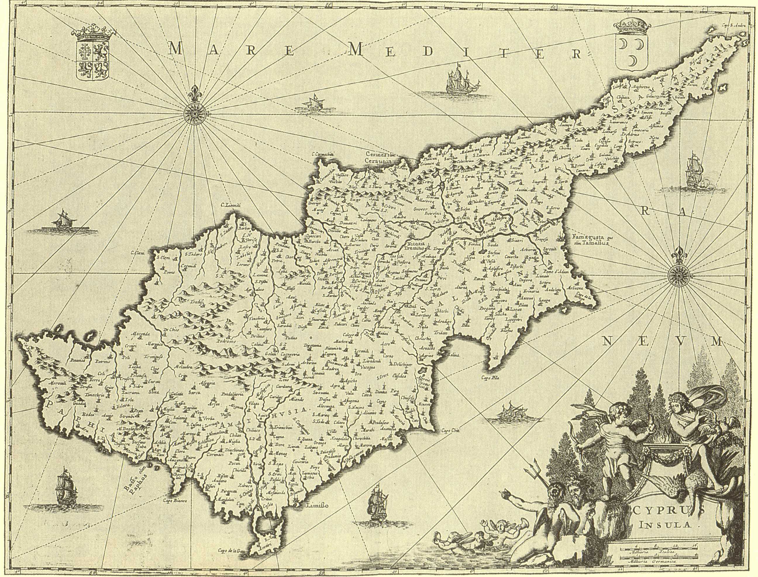
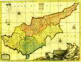
Olfert (Olivier) DAPPER , Description Exacte Des Isles De L' Archipel , Amsterdam 1703 . Folio (360x270mm) . French .
A folio book originally published in Dutch as Naukeurige Beschryving der Eilanden in de Archipel der Middelantsche Zee...(Amsterdam 1688) . The present , French edition was published by George Gallet in Amsterdam . Dapper's book is a magnificent production as far as printing is concerned and at the same time an interesting source for the islands of the Archipelago . Dapper never visited the places he described in his book . He compiled his descriptions from the writings of known travellers , or from the accounts of seamen . The text on Cyprus ("De l'Ile de Cypre") on pages 21-88 , is preceded by a double-page map of the island entitled "Cyprus Insula" (287x374mm) (the one above) . The author of the map remains unknown but his prototype was Blaeu or Janssonius (Fig. 37) Dapper's map is basically distinguished from its prototype because of a new marine composition at the lower right corner that replaces Blaeu's Aphrodite and swans of Fig. 37 .The extensive text is illustrated with two other Cyprus items . The first is a town plan of "Famagouste" (125x160mm) (see Fig.49) on page 30 which accompanies the relevant account entitled "De la ville de Famagouste" (pp 29-31) . It is a conventional , three-dimensional view which does not include the numerous churches of the town (Fig. 49) . Nevertheless , it is an important plan for the study of the town's fortification system , as it resembles a wooden model at the Museo Storico Navale in Venice which is labelled "Fortezza di Famagosta" and dated 1571 (see also Fig. 56) . The last Cyprus item is a double-page engraved illustration of the Larnaca harbour seen from the sea and depicting the fort and the church of St. Lazarus . It is entitled "Salinas of Soutpannen anders Arnica di Salinas ou les Salines" (280x343mm) and it precedes the relevant account , "De la ville d' Arnica ou D' Arnacho" on pages 33-35 .
|
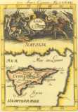
Dapper, Olfert (Olivier)
Map of Famagusta
(1'215'579 bytes) |
1703
|
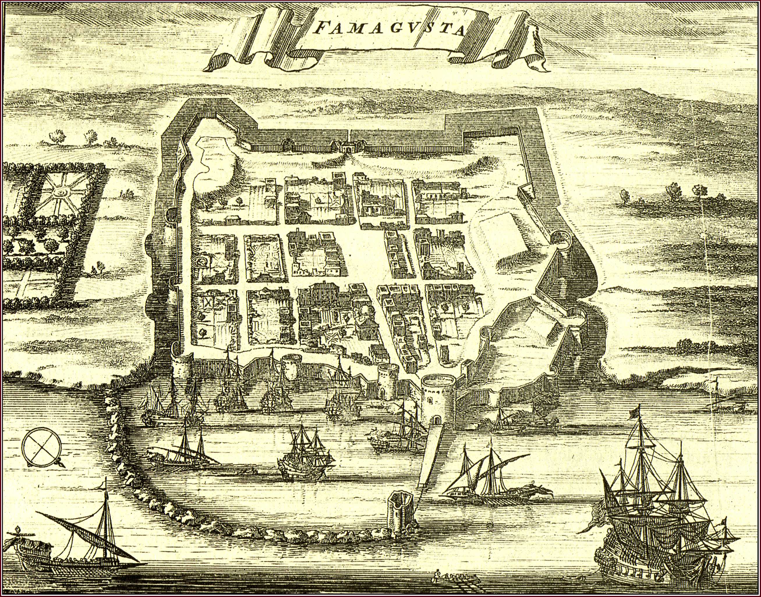
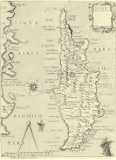
Olfert (Olivier) DAPPER , Description Exacte Des Isles De L' Archipel , Amsterdam 1703 . Folio (360x270mm) . French .
A folio book originally published in Dutch as Naukeurige Beschryving der Eilanden in de Archipel der Middelantsche Zee...(Amsterdam 1688) . The present , French edition was published by George Gallet in Amsterdam . Dapper's book is a magnificent production as far as printing is concerned and at the same time an interesting source for the islands of the Archipelago . Dapper never visited the places he described in his book . He compiled his descriptions from the writings of known travellers , or from the accounts of seamen . The text on Cyprus ("De l'Ile de Cypre") on pages 21-88 , is preceded by a double-page map of the island entitled "Cyprus Insula" (287x374mm) (Fig. 48). The author of the map remains unknown but his prototype was Blaeu or Janssonius (Fig. 37) Dapper's map is basically distinguished from its prototype because of a new marine composition at the lower right corner that replaces Blaeu's Aphrodite and swans of Fig. 37 .The extensive text is illustrated with two other Cyprus items . The first is a town plan of "Famagouste" (125x160mm) (the one above) on page 30 which accompanies the relevant account entitled "De la ville de Famagouste" (pp 29-31) . It is a conventional , three-dimensional view which does not include the numerous churches of the town . Nevertheless , it is an important plan for the study of the town's fortification system , as it resembles a wooden model at the Museo Storico Navale in Venice which is labelled "Fortezza di Famagosta" and dated 1571 (see also Fig. 56) . The last Cyprus item is a double-page engraved illustration of the Larnaca harbour seen from the sea and depicting the fort and the church of St. Lazarus . It is entitled "Salinas of Soutpannen anders Arnica di Salinas ou les Salines" (280x343mm) and it precedes the relevant account , "De la ville d' Arnica ou D' Arnacho" on pages 33-35 .
|
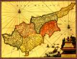
Valk, Gerard and Schenk, Pieter
Map of Cyprus
(866'915 bytes) |
1705
|
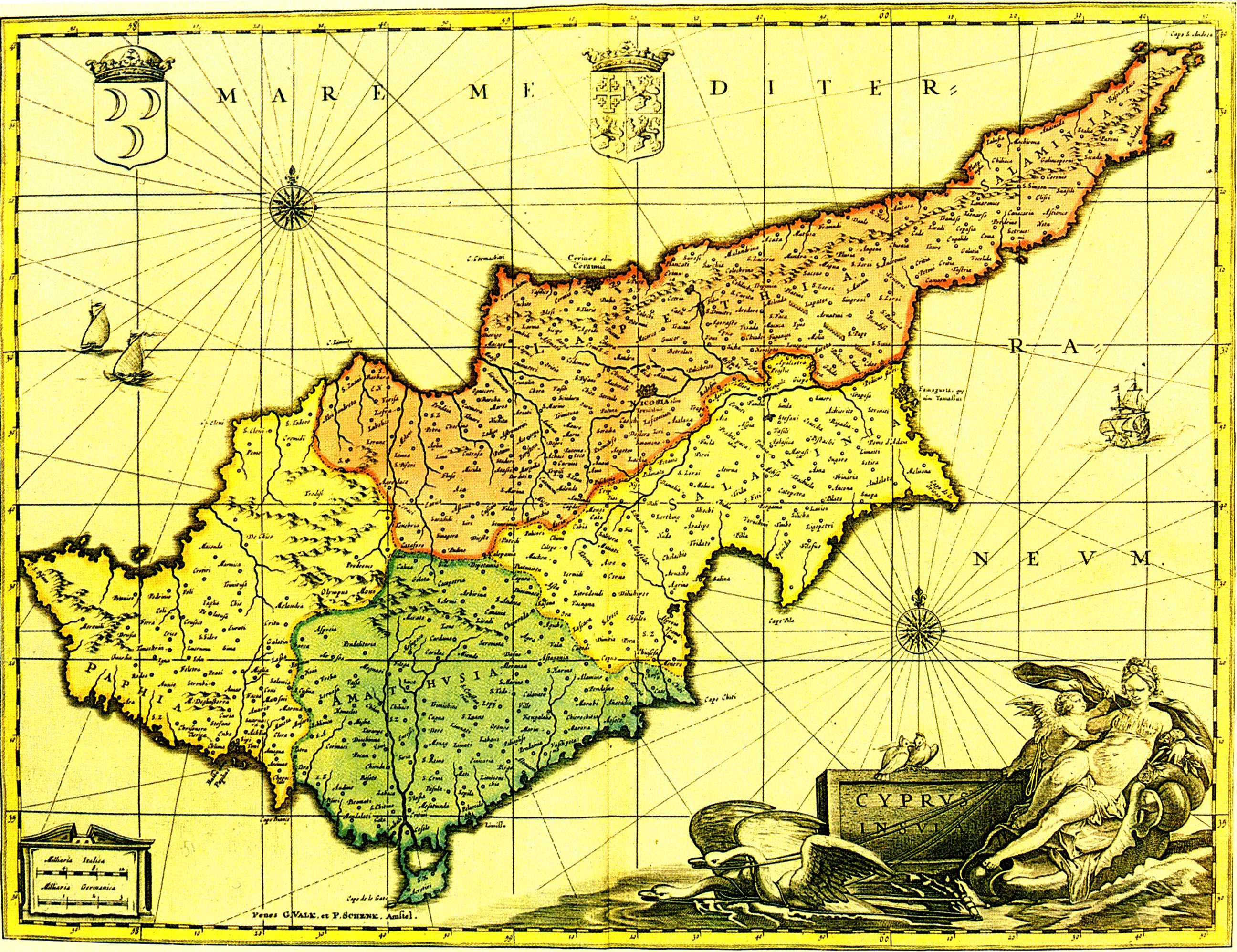
Gerard VALK et Petrus SCHENK , "Cyprus Insula" (380x500mm) , Amsterdam ca 1705 . Coloured .
Janssonius was not the only cartographer guilty of copying maps by great cartographical publishers , like Blaeu . The cartographical house of Valk and Schenk , having obtained after 1676 copper-plates from Joannes Janssonius' heirs , worked the Cyprus plate . This had been made by Janssonius in 1637 when he copied Blaeu's original (Fig. 37) of 1635 . In this manner Nocosia seems to have been corrected to Nicosia but it is still uncertain when the map was first published by Valk and Schenk in this second , amended state . In any case , it is found in a collection of maps published ca 1705 in Amsterdam . It is a handsome map to look at , but of no cartographical importance .
|
Lasor A Varea (Savonarola), Alfonsus
Map of Cyprus
(811'586 bytes) |
1713
|
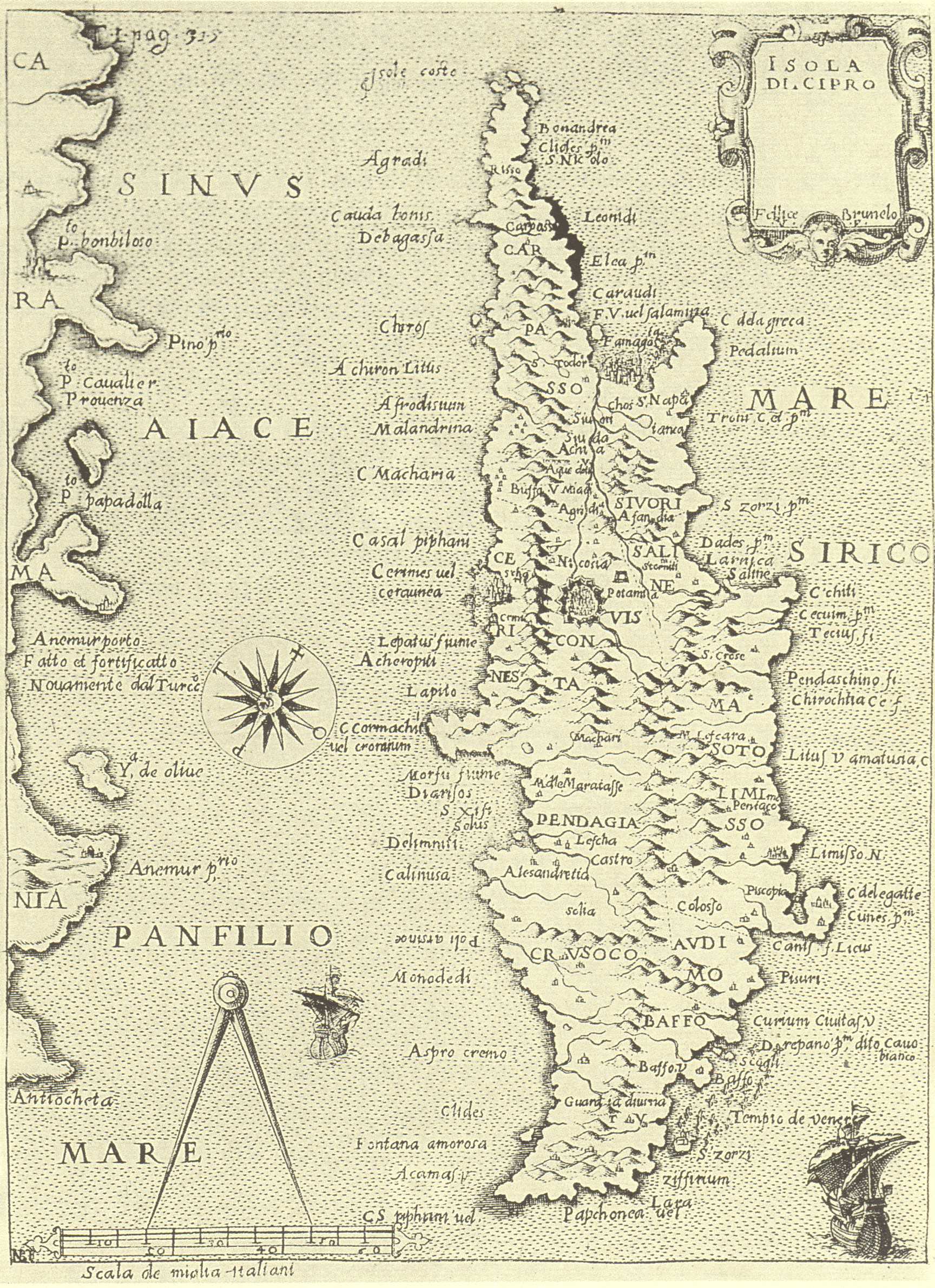
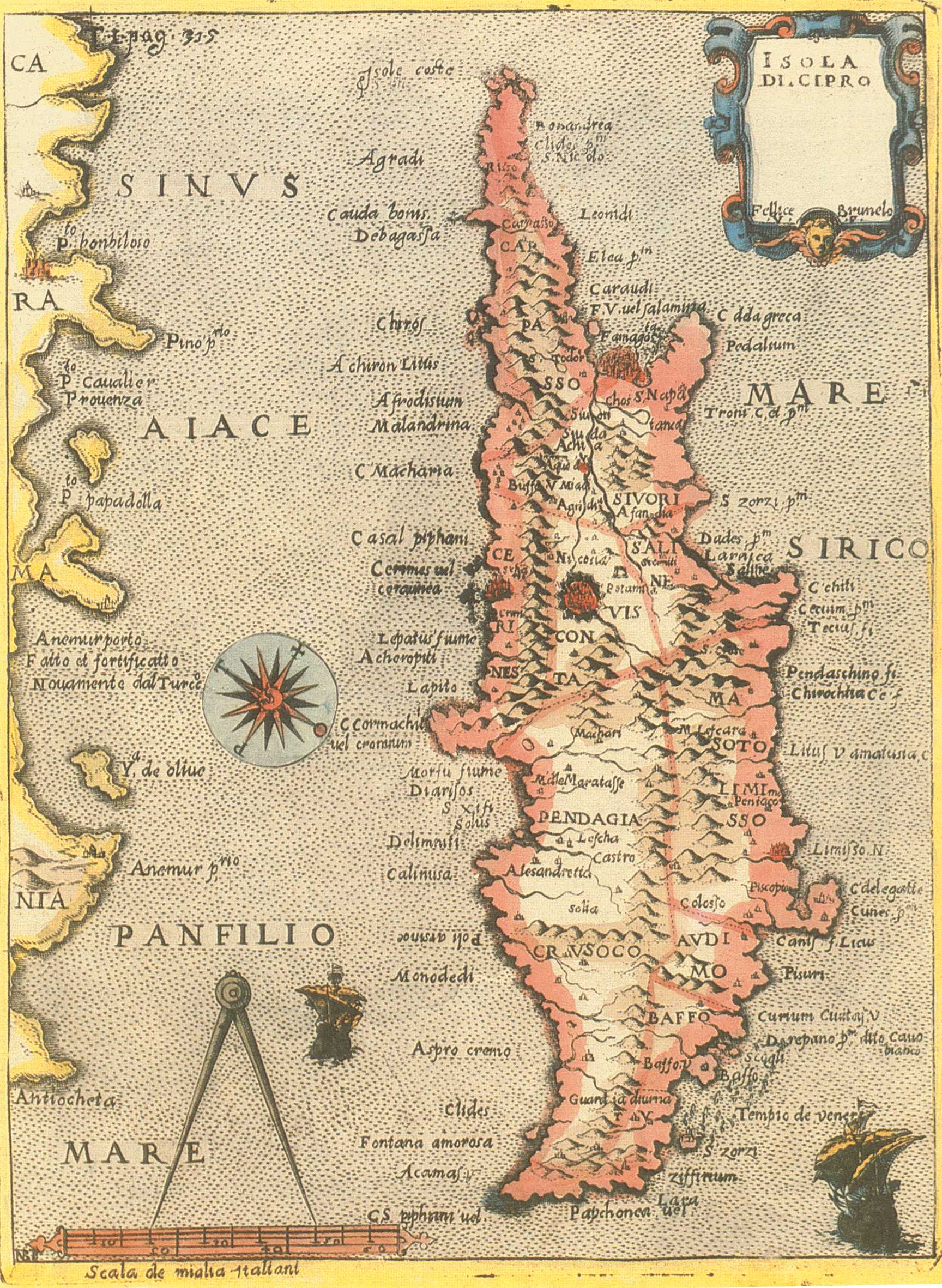
Alfonsus LASOR A VAREA (SAVONAROLA) , "Isola di Cipro , Fellice Brunelo , V.F." (212x157mm) , Universus Terrarum Orbis , Patavia 1713 . Latin .
The case of Lasor , pseudonym of Innocenzo Rafaele Savonarola , is a fine example that illustrates the reuse of old plates of the end of the 16th. century in books of the 18th. century . There are various items concerning Cyprus in Lasor's book , Universus Terrarum Orbis. In volume I there is a map of Cyprus first published in Venice ca 1590 in Raccolta de Disegni...da Venetia a Constantinopoli (same map as in the Viaggio , entry 18 fig. 21) ; and also the present map of Cyprus which , though slightly reworked , is the map engraved by Natale Bonifacio whose monogram , "N.B.F." occurs at the bottom left corner . This map was originally published by Fellice Brunelo ca 1590 in Venice . It was subsequently used in various isolaria at the end of the 16th. century and here it is being employed by Lasor with page legend "T.I. pag. 315" engraved in the upper left corner of the map surface .(This is the same map as Fig . 109 of the present collection with the difference that it is a little larger and not coloured) .
|
Lasor A Varea (Savonarola), Alfonsus
Map of Nicosia
(1'080'801 bytes) |
1713
|
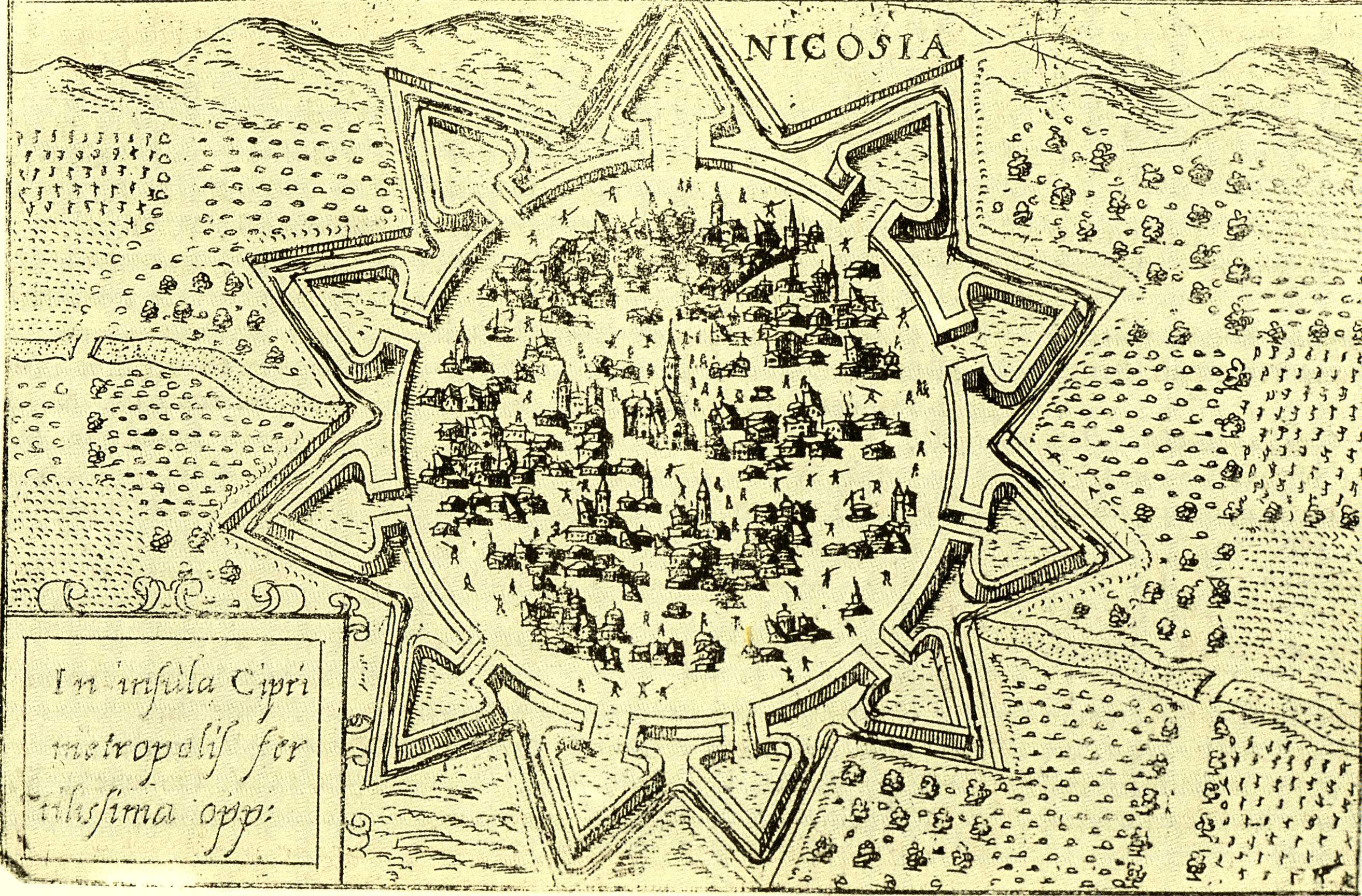
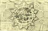
Alfonsus LASOR A VAREA (SAVONAROLA) ,Francesco VALEGIO , "Nicosia" - "In Insula Cipri..."(87x132mm) page 258 ,Universus Terrarum Orbis... , Patavia 1713 . Latin .
Another Cyprus item in the second volume of Lasor's book is this conventional plan of Nicosia with the Venetian walls . This plan was first published ca 1579 in Venice in the towns-book , Raccolta di le piu illustri et famose citta di tutto il mondo , by Francesco Valegio . Valegio's plan is based on a siege-plan of Nicosia published by Gamocio ca 1570 , but it eliminates all the pictorial elements concerning the siege and replaces the Turkish forces around the walls with cultivated land .
|
Lasor A Varea (Savonarola), Alfonsus
Map of Famagusta
(921'264 bytes) |
1713
|
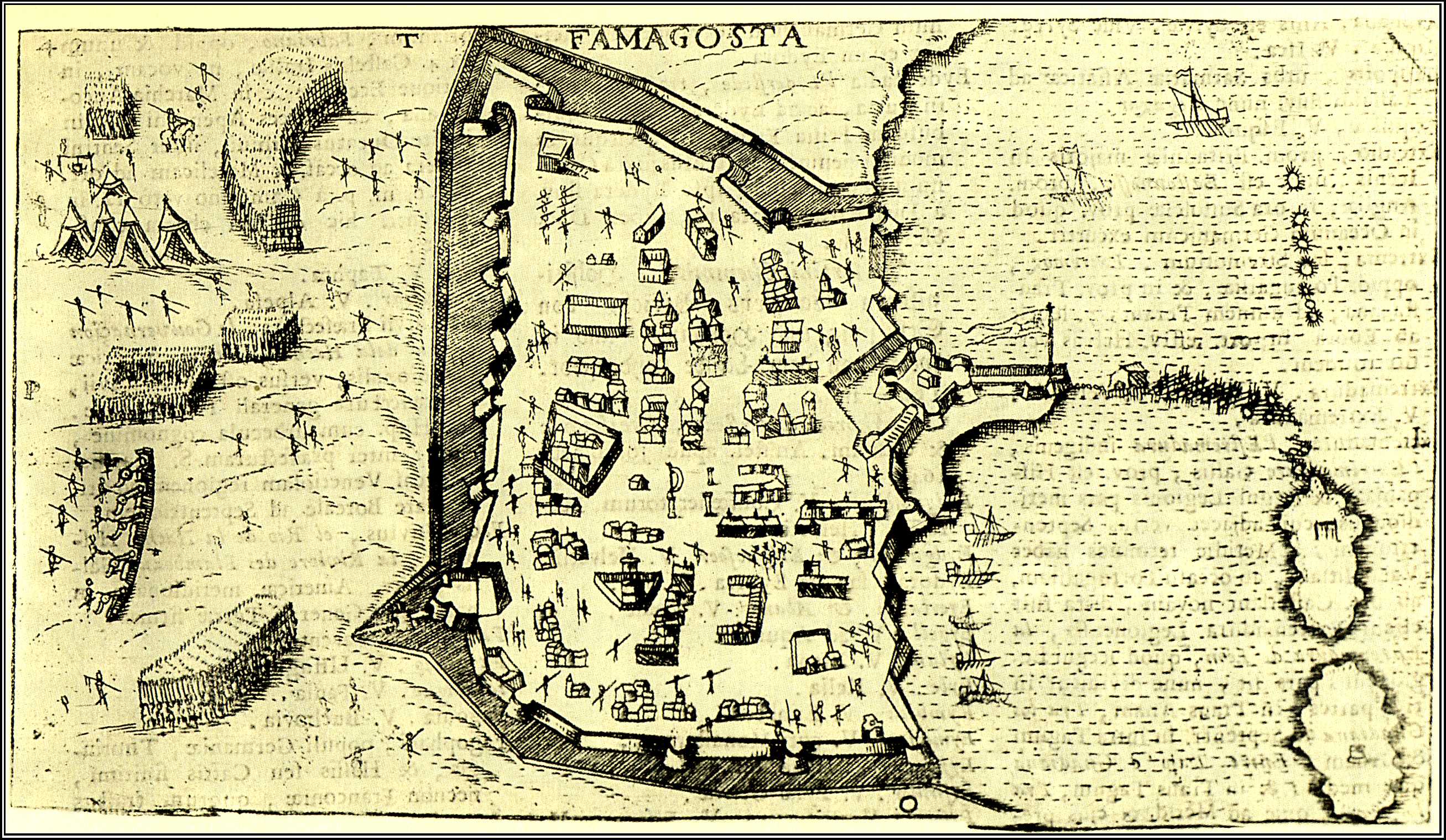
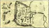
Alfonsus LASOR A VAREA (SAVONAROLA) , "Famagosta" (100x178mm) page 370 ,Universus Terrarum Orbis... , Patavia 1713 . Latin .
Like the map of Cyprus (Fig. 59) , this plan of Famagusta from the first volume of Lasor's book , originated in Raccolta de Disegni...da Venetia a Costantinopoli , a booklet published in Venice ca 1590 . This is the very same siege-plan of "Famagosta" engraved by Gioseppe Rosaccio in the late 16th. Century and encountered in the Viaggio which was published in 1598 by Jacomo Franco (see entry of Fig. 22) .
|
Lasor A Varea (Savonarola), Alfonsus
Map of Cyprus
(701'604 bytes) |
1713
|
Alfonsus LASOR A VAREA (SAVONAROLA) , "Isola di Cipro , Fellice Brunelo , V.F." (205x152mm) , Universus Terrarum Orbis , Patavia 1713 . Latin . Coloured .
The case of Lasor , pseudonym of Innocenzo Rafaele Savonarola , is a fine example that illustrates the reuse of old plates of the end of the 16th. century in books of the 18th. century . There are various items concerning Cyprus in Lasor's book , Universus Terrarum Orbis. In volume I there is a map of Cyprus first published in Venice ca 1590 in Raccolta de Disegni...da Venetia a Constantinopoli (same map as in the Viaggio , entry 18 fig. 21) ; and also the present map of Cyprus which , though slightly reworked , is the map engraved by Natale Bonifacio whose monogram , "N.B.F." occurs at the bottom left corner . This map was originally published by Fellice Brunelo ca 1590 in Venice . It was subsequently used in various isolaria at the end of the 16th. century and here it is being employed by Lasor with page legend "T.I. pag. 315" engraved in the upper left corner of the map surface .(This is the same map as Fig . 59 of the present collection with the difference that it is a little smaller and coloured) .
|
Mallet, Alain Manesson
Map of Cyprus
(513'681 bytes) |
1719
|
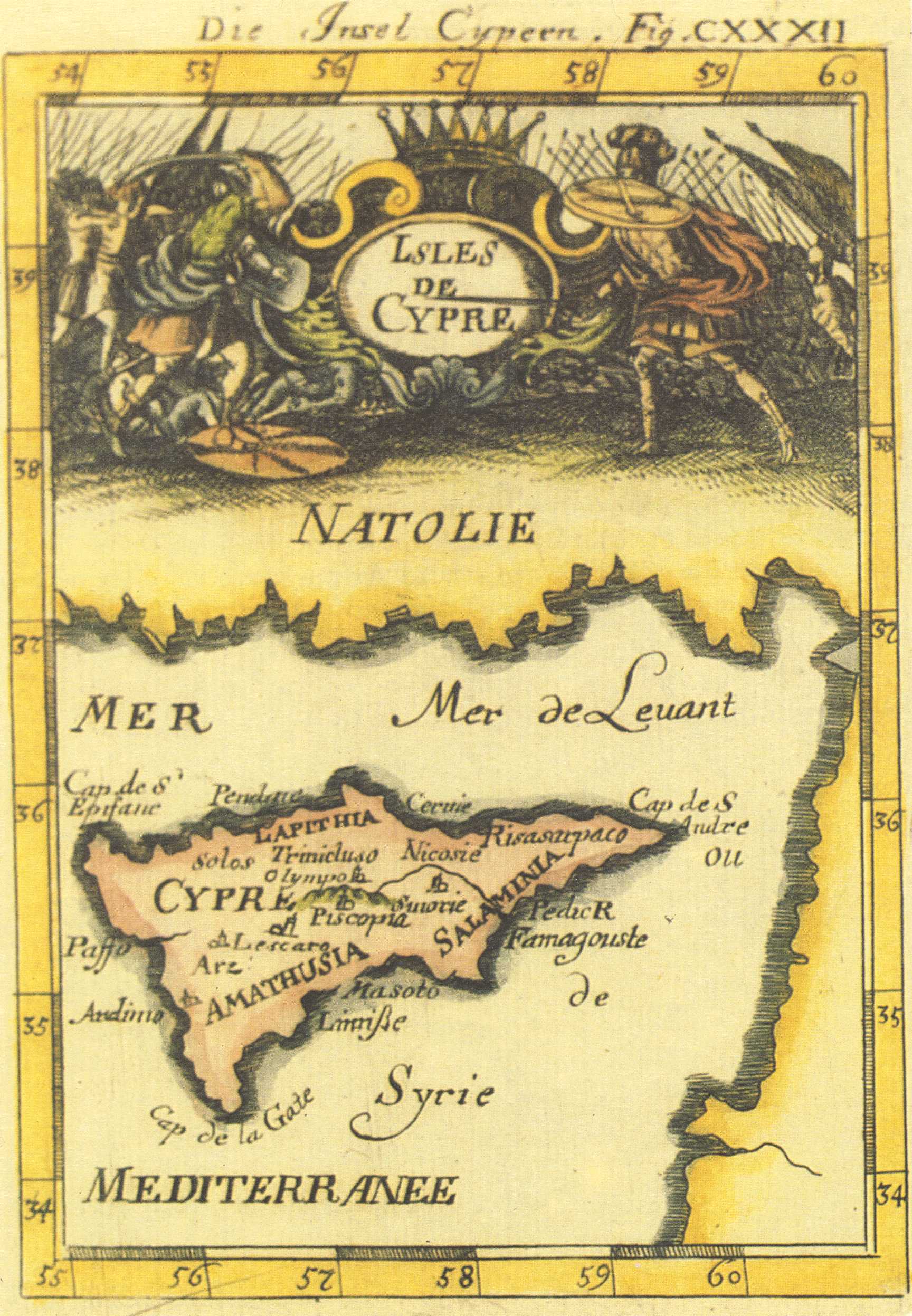
Alain Manesson MALLET , "Die Insel Cypern" - "Fig. CXXXII" (139x98mm) , Description de l' Univers , Frankfurt 1719 . German . Coloured .
This map , not recorded in the Stylianou book , The History of the Cartography of Cyprus , is included in the Description de l' Univers first published in French by D. Thierry in Paris in 1683 . The author , Mallet , was an engineer , and the book which was in five volumes contained maps , plans and city views . In the first edition , the map of Cyprus has a page number (297) and text on verso . The present map comes from the German edition of 1719 entitled Beschreibung des ganzen Welt-Kreisses published by J.A. Jung . The maps of the German edition are copied on new plates from those of the French edition (see Fig. 62Haj) but have no text on verso . A figure number is written after the German title , "Die Insel Cypern", on the top right margin outside the borders of the map .
|
Aa, Pierre vander
Map of Cyprus
(495'799 bytes) |
1730
|
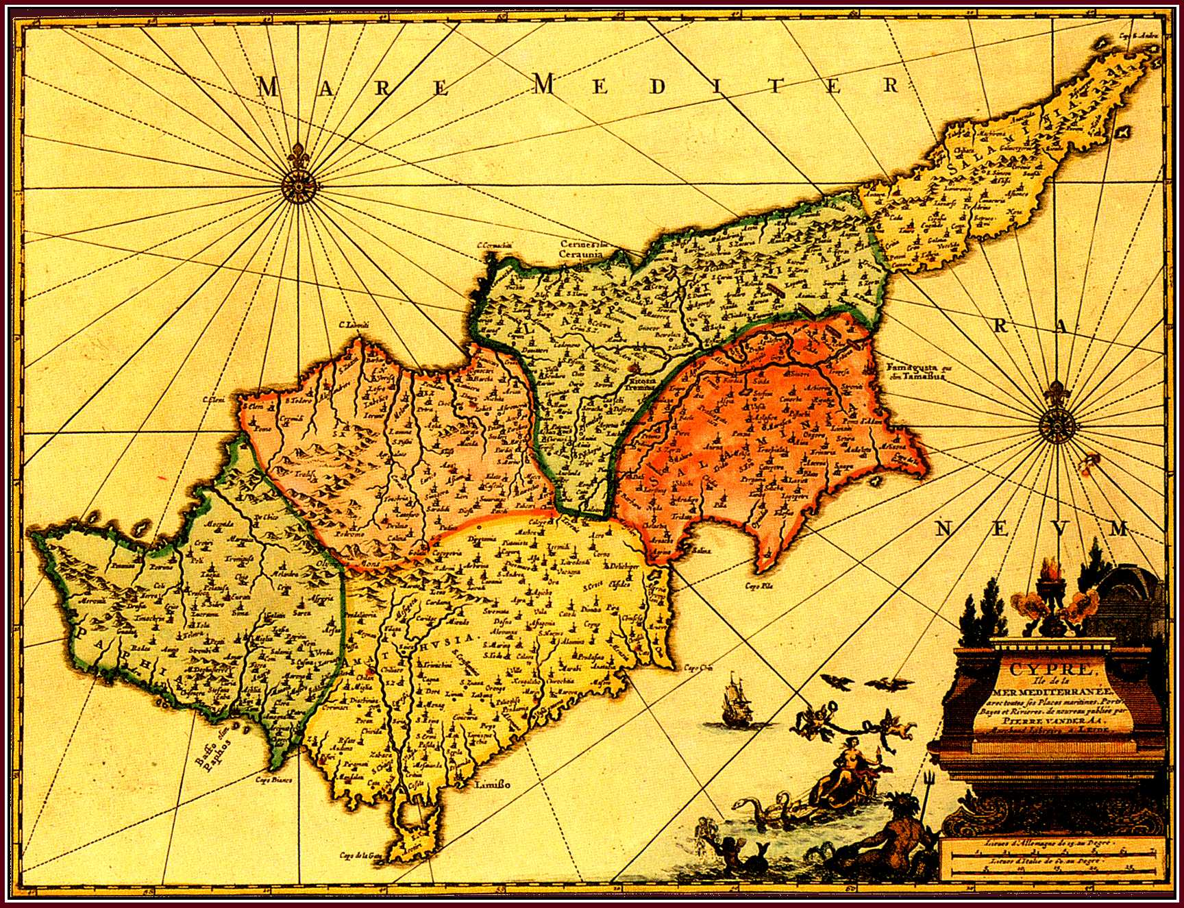
Pierre (Pieter) van der AA . "Cypre Ile de la Mer Mediterranee ..." (286x376mm) , Nouvel Atlas , Leiden 1714 or 1730 . Coloured .
This map by van der Aa copies the Cyprus map of Blaeu (Fig. 37) . It is smaller in size and Blaeu's exquisite decorative treatment has been replaced by a cartouche and new pictorial motifs . The map was first published by van der Aa in his Nouvel Atlas (1714) which ca 1730 was re-issued in Amsterdam . Finally , ca 1729/30 the map was included in the very rare multi-volume atlas of van der Aa , La Galerie Agreable du Monde (Leiden) .
|
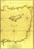
Roux, Joseph
Map of Levant
(1'255'317 bytes) |
1764
|
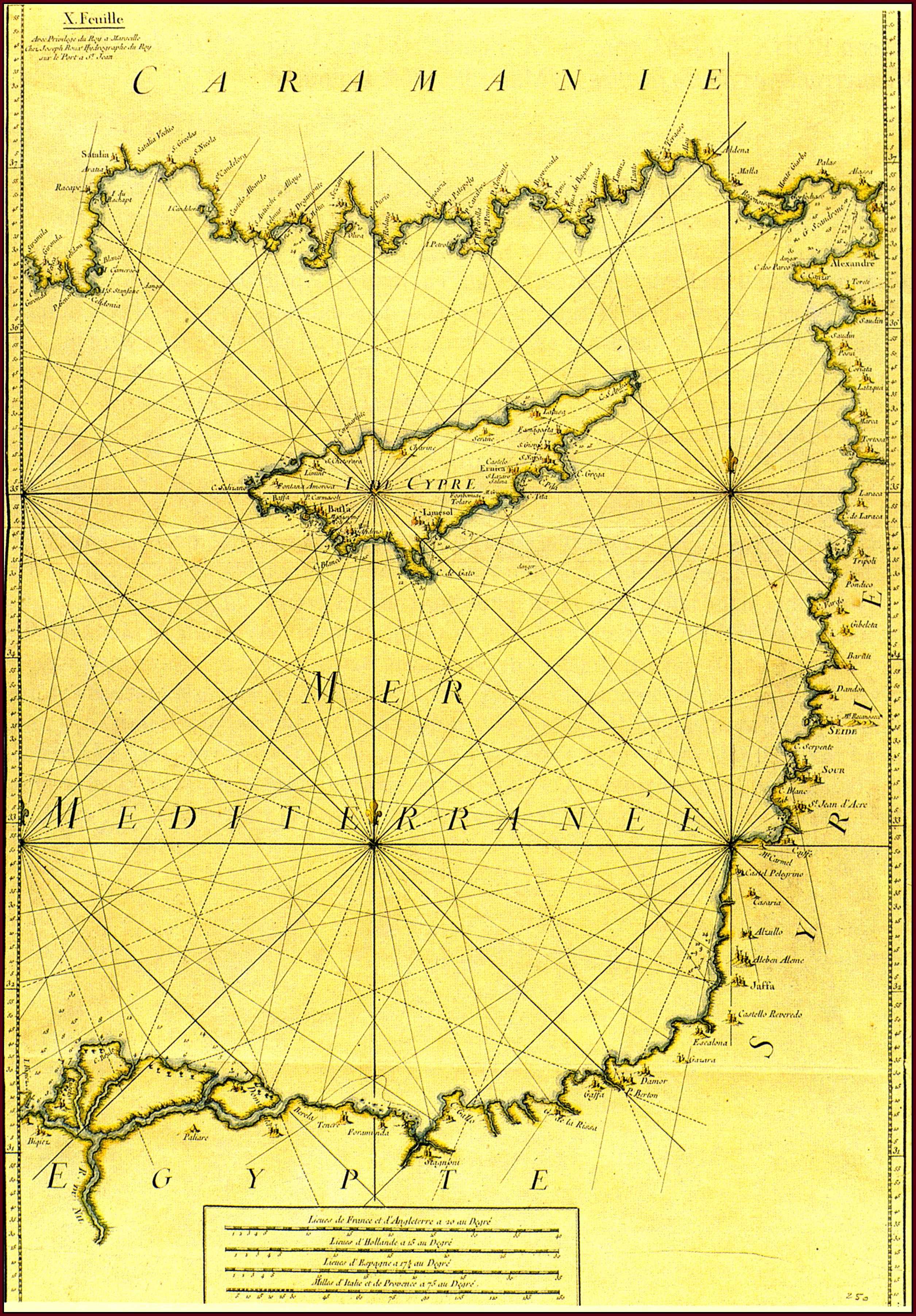
Joseph ROUX , "I. De Cypre" - "X. Feuille" (813x555mm) , Carte de la Mer Mediterranee en douze feuilles..., Marseille 1764 . Coloured .
This sea-chart is the tenth of twelve maps in J. Roux's Carte de la Mer Mediterranee from which he extracted and published in the same year(Marseille 1764) his Recueil of the main ports around the Mediterranean (Fig. 68) . The chart shows not only Cyprus , but also the coastlines around the Eastern Mediterranean . The map of Cyprus does not follow any of the established cartographical renderings of the island . This indicates how completely different the line of development was as far as sea-charts were concerned , since they were made by sailors for navigation purposes . For the same reason , most of the contents are on the south coast where navigation was more frequent and the place names are heavily corrupted since they are written the way they were pronounced by sea-men . After ca 1779 another plate was made for this map , but the present copy is from the original plate .
|