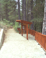
Cyprus nature trail
 The Forestry Department has created a number of trails within the state forests in various parts of the island, from Cape Gkreko in the southeast to Akamas peninsula in the west.
These have been carefully designed to cover areas of rich natural vegetation and cultural interest. They have been landscaped on gentle gradients and are, as a rule, circular so that all age groups can easily use them.
In many cases, there are signposts in place, to indicate the starting point of the trail, as well as flora and geology features along the route.
Although walking in Cyprus can be enjoyed throughout the year, the recommended seasons are during late Autumn (November) and spring, when the Cyprus rural and forest areas are at full bloom.
Degree of difficulty of trails
All nature trails are divided into 3 categories according to the degree of difficulty, as follows:
Category 1: Easy trail, with gentle gradient. Suitable for all ages and state of fitness.
Category 2: Medium degree of difficulty, suitable for adults in generally average to good state of fitness. Sudden changes in gradient (uphill and/or downhill), and/or course along narrow or rough terrain.
Category 3: High degree of difficulty. Route with difficult terrain such as sudden changes in gradient (uphill and/or downhill), course along particularly rough and/or slippery, and/or narrow, and/or steep terrain. Suitable for adults in generally good to very good state of fitness.
1. Aphrodite Trail (circular)
Starting point: Baths of Aphrodite. The section between the Baths and Pyrgos tis Rigainas (the Castle of Regina - Queen's Tower) is shared with the Adonis trail. The trail follows a rising path to the hill known as Moutti tis Sotiras (370m) and this can be quite tiring, especially in summer. There are springs with drinking water at two points,one at Pyrgos tis Rigainas (the Castle of Regina) and the other at Kefalovrisia.
Length: 7.5 km - Duration: 3 hours - Degree of difficulty: 2
Points of interest: The baths of Aphrodite where, according to tradition, the Goddess of Love used to bathe. Ruins of the Pyrgos tis Rigainas (Queen's Tower), which are believed to have belonged to a medieval monastery. It is worth mentioning the huge centuries-old oak tree which can be seen at the picnic site, where drinking water is also available. Along the trail there are several points which give a view of Polis Chrysochous and the Pafos Forest. Along the route, there are two potable water fountains, one near the ruins of Pyrgos tis Rigainas (Queen's Tower) and one between location Loutra and Kakoskali. The trail links with Adonis trail.
2. Adonis Trail (circular)
Starting point: Baths of Aphrodite. Like Aphrodite Trail, the walk can be quite tiring. Two springs of drinking water can be found at Pyrgos tis Rigainas and Kefalovrysia.
Length: 7.5 km - Duration: 3 hours - Degree of difficulty: 3
Points of interest: From the western part there is a view of various beaches of Akamas, such as Lara Bay, Tzioni, Karavopetres, etc. The path goes past Pyrgos tis Rigainas (Queens Tower). At Kefalovrysia location it links up with Smiges trail. In order to complete its circular path the trail follows the main road connecting the Baths of Aphrodite and Polis, for about 400m.
3. Smigies Trail (circular)
Starting point: Smigies picnic site, 2.5 km from Neo Chorio
Length: (a) short route 2.5 km Time: (a) short route 1 hour
Length: (b) long route 5 km Time: (b) long route 2 hours
Degree of difficulty: 2
Points of interest: View to the east of Polis Chrysochous Bay, Latsi, Pachyammos and Pafos Forest, and to the west Lara Bay, Tzioni, Karavopetres, etc. The long route goes past the disused magnesium mines which include a deserted kiln and then through a dense part of Akamas forest. The long rout links up with Adonis trail at the location Kefalovrysia (potable water fountain location). At their starting point both trails pass by Piana fire lookout station.
4. Pissouromoutti Trail (circular)
Starting point: Smigies picnic site
Length: 3 km - Duration: 1 1/2 hours - Degree of difficulty: 2
Points of interest: Rich growth of Juniper Phoenicia, pistacia, etc. Views of Polis Bay to the northeast and beaches of Akamas to the west.
5. Agia Eirini - Limeria (Spilies tou Digeni) Trail (Linear)
Starting point: Agia Eirini village. Location Selladi tis Straorouthkias is accessed 2 km of loose surface road from Spilia village, thereon walking for a further 2 km towards location Limeria.
Length: 5 km - Duration: 2.5 hours - Degree of difficulty: 3 due to steep, ascending gradient
Points of interest: The trail passes through rich forest vegetation offering excellent views towards Morfou Bay and the opportunity to visit various hideouts used by E.O.K.A*. At the location Selladi tis Straorouthkias the trail meets the Kourdali-Limeria (Spilies tou Digeni) trail. Both trails continue on a common route for 2 km.
6. Kourdali - Limeria (Spilies tou Digeni) (Trail (Linear)
Starting point: Kourdali village. Location Selladi tis Straorouthkias is accessed 2 km on loose surface road from Spilia village, thereon walking for a further 2 km towards location Limeria.
Length: 3.6 km - Duration: 1.5 hours - Degree of difficulty: 2
Points of interest: The trail passes through rich forest vegetation offering the opportunity to visit various hideouts used by E.O.K.A*. At location Selladi tis Straorouthkias the traiI meets Agia Eirini-Limeria (Spilies tou Digeni) trail. Both trails continue on a common route for 2 km.
*Ethniki Organosi Kyprion Agoniston (E.O.K.A), National Organisation of Cypriot Fighters, fought an anticolonial, liberation war during period 1955-59.
7. Moutti tis Choras-Selladi tou Karamanli Trail (Linear)
Starting point: (a) Location Moutti tis Choras, I km past the village of Spilia towards Agia Eirini and Kannavia villages. (b) Location Selladi tou Karamanli, 1.5 km from Spilia on loose surface road.
Length: 3.8 km - Duration: 1.5 hours - Degree of difficulty: 2
Points of interest: Old trail offering excellent views towards Morfou Bay. Connects with the local area network of trails such as Doxa si o Theos-Moutti tis Choras, Madari-Selladi tou Karamanli and Selladi tou Karamanli-Kannavia. The trail passes through rich forest vegetation known locally as Mavra Dasi (Black Forests). Midway through the trail there is a smaller path leading to a giant Kermes oak tree - Quercus coccifera ssp. Calliprinos.
8. Doxa si o theos-Moutti tis Choras Trail (Linear)
Starting point: (a) Location Doxa si o Theos, 2 km from Kyperounda sanatorium/emergency centre, or 5 km from Spilia village on the Kyperounda-Spilia village towards Agia Eirini/Kannavia villages.
Length: 1.8 km - Duration: 30 minutes - Degree of difficulty: 1I
Points of interest: A forest loose surface road trail. Offers excellent views towards Morfou Bay. Connects with the local area trail network of Doxa si o Theos-Madari and Moutti tis Choras-Selladi tou Karamanli. At starting point (a) there is a fountain with potable water.
9. Doxa si o Theos-Madari Fire Lookout Station Trail (Linear)
Starting point: (a) Location Doxa si o Theos, 2 km from Kyperounda sanatorium/first aid centre or 5 km from Spilia village on Kyperounda-Spilia main road. (b) Madari fire lookout station. Vehicular access from Chandria-Polystypos main road, towards the Adelfoi peak. The route is surfaced during its initial 800m. The final 800m are on uneven, narrow and steep loose surface road.
Length: 3.8 km - Duration: 2 hours - Degree of difficulty: 3
Points of interest: Panoramic views all around from an altitude of 1400-1600m, along Madari range. The trail ends near the Adelfoi peak (1613m). Ramblers have the opportunity to visit Madari fire lookout station overlooking the area. Connects with the local area trail network of Madari-Selladi tou Karamanli and Doxa si o Theos-Moutti tis Choras. At starting point (a) there is a fountain with potable water.
10. Teichia tis Madaris Trail (Circular)
Starting point: Near Madari fire lookout station, by the end point of Doxa si o Theos-Madari trail. The starting point can be accessed by vehicle from Chandria-Polystypos main road in the direction of Adelfoi peak, 3 km away. The road is surfaced up to the lower starting point of the trail.
Length: 3 km - Duration: 1.5 hours - Degree of difficulty: 2
Points of interest: High, impressive cliffs all along the trail. Trails through an interesting geological area. Excellent views towards Mesaoria plain and Morfou Bay. It connects with the trails Madari-Doxa si o Theos and Madari-Selladi tou Karamanli.
11. Madari-Selladi tou Karamanli Trail (linear)
Starting point: Near Madari fire lookout station. Vehicular access from the Chandria - Polystypos main road. The final 800m of the access road is on loose surface road, rugged and steep. Ends up at location Selladi tou Karamanli, where there is access towards Saranti village (1.5 km surfaced road) and Spilia village (6 km loose surface road).
Length: 3.5 km - Duration: 1.5 hours - Degree of difficulty: 3, difficult descending route
Points of interest: Excellent views towards Morfou Bay, Mesaoria plain and Troodos range. About half way through, the route trails through a cedar forest. It connects with the local area trail network of Madari-Doxa si o Theos, Teichia tis Madaris, Moutti tis Choras-Selladi tou Karamanli and Selladi tou Karamanli-kannavia. Through a surfaced road of 2 km it connects with the Lagoudera-Agros trail.
12. Selladi tou Karamanli-Kannavia Trail (linear)
Starting point: Location Selladi tou Karamanli on the main road from Saranti village to Spilia village. The part of the road from Saranti village is surfaced whilst the part of the road from Spilia village is on loose surface road. Ends at Kannavia village.
Length: 3 km - Duration: 1.5 hours - Degree of difficulty: 3
Points of interest: Part of the route runs through forest area. Scenic views towards the nearby valley. Connects with local area trail network of Madari-Selladi tou Karamanli and Moutti tis Horas-Selladi tou Karamanli.
13. Panagia tou Araka-Stavros tou Agiasmati Trail (Linear)
Starting Points: (a) Panagia tou Araka church, Lagouthera village (b) Stavros tou Agiasmati church (8 km from Platanistasa village)
Length: 7 km - Duration: 3 hours - Degree of difficulty: 3
Points of interest: The churches of Panagia tou Araka (1192 A.D) and Stavros tou Agiasmati (1494 A.D) with their excellent frescoes. Both churches are listed UNESCO World Heritage sites. Special prior arrangements must be made to open the Church of Stavros tou Agiasmati. The trail runs through dense pine forest, orchards, almond trees and past old stone terraces. To the east of the trail lies Kionia peak, to the north Morfou Bay and the Pentadaktylos range, to the west Olympos mountain and to south Madari area. The trail is connected with Lagoudera or Agros-Madari trail.
14. Asinou - Agios Theodoros Trail (Linear)
Starting points: (a) Asinou church (b) Agios Theodoros village in Solea valley
Length: 5.6 km - Duration: 1.5-2.0 hours - Degree of difficulty: 2
Points of interest: Varied landscape, panoramic view to Morfou Bay. The route goes through forested area, along a path and a rural road. The 12th century A.D church of Asinou with its famous frescoes, a listed UNESCO World Heritage site.
15. Horteri Trail (Circular)
Starting Point: "Platanouthkia" site, about halfway on the Stavros tis Psokas - Selladi tou Stavrou road. Initially, the trail follows an upward course and can be tiring, especially in summer.
Length: 5 km - Duration: 2 hours - Degree of difficulty: 3
Points of interest: An outstanding view of the valley of Stavros and the Forest Station. Near the starting point is a spring with drinking water.
16. Selladi tou Stavrou - Heliport
Starting point: Selladi tou Stavrou
Length: 2.5 km - Duration: 1 hour - Degree of difficulty: 1
Points of interest: An outstanding view of the Stavros valley. For a long walk, hikers can walk from the Forest Station to Selladi tou Stavrou, via the forest road, then along a trail back to Stavros via the forest road. The route is 5 kms long, and takes 2.5 hours.
17. Enetika Gefyria (Venetian Bridges) Trail (Linear)
Starting points: (a) Kaminaria village (b) Vretsia village
Length: 17 km - Duration: 6 hours, Intermediate distances/duration: kaminaria village - Elia Bridge 3.2 km - 1 hour, Elia Bridge - Tsielefos Bridge 3.9 km - 2 hours, Tsielefos Bridge -Roydia Bridge 6.9 km - 2 hours, Roydia Bridge - Vretsia village 3 km - 1 hour.
Degree of difficulty: 3
Points of interest: The medieval bridges of Elia, Tsielefos, and Roydia. The view all along the way is panoramic. Goes through dense pine forest, over Arminou dam, past Pera Vasa picnic site (a huge dry tree trunk of the Pera Vasa pine exhibited here), and continues through "Saouris" farm belonging to Kykkos monastery, past the Cave of Saouris, "Mita?s pen and near the vultures" observation point.
18. Ariadni Trail (Circular)
Starting point: From
Length: 5 km - Duration: 2.5 hours - Degree of difficulty: 3
Points of interest: Excellent views. It goes past the picturesque village of Gerakies in the Marathasa valley, nestling on the hillside amongst lush vegetation, on the fringes of Pafos forest. Ascends to the south of
19. Prodromos Reservoir - Stavroulia
Trail (Linear)
Starting point: Along the main Troodos Square - Prodromos village road, over Prodromos reservoir. For the trail end there are two options on separate points on the Pedoulas - Agios Nikolaos loose surface road.
Length: First option: 4.5 km - Second option: 4.5 km
Duration: 1.5 - 2 hours - Degree of difficulty: 3, steep downhill gradient
Points of interest: Excellent views towards Morfou Bay and Troodos range. The trail passes through very dense pine forest. Further panoramic views eastwards towards the now disused chromium mine installations.
20. Kannoures - Agios Nikolaos Tis Stegis (Kakopetria) Trail (linear)
Starting point: On the main karvounas - Troodos square road, 1 km before Troodos square (Plateia Troodous), 9.5 km from location Karvounas. Ends at Agios Nikolaos tis Stegis church, or continues up to kakopetria village.
Length: 9km (12 km up to Kakopetria village) - Duration: 3 hours (4 hours up to Kakopetria village) - Degree of difficulty: 3 due to its length. Relatively easy, mainly downhill route.
Points of interest: Forest landscape. Starts by the stream if river Karyotis and follows the scenic river valley. Goes past the now disused chromium mine installations and ends by the 12th century A.D. church of Agios Nikolaos tis Stegis with its excellent frescoes, a listed UNESCO World Heritage site. From Agios Nikolaos tis Stegis the route may continue on the Pedoulas - Kakopetria main road for about 3km, to reach Kakopetria village.
21. Mnimata piskopon trail (linear)
Starting point: On the main Troodos - Karvounas road, 1.5 km before Troodos square (Plateia Troodous), 9 km from location Karvounas, at Kampos tou Livadiou picnic site. The starting point is approximately 300 m along the narrow paved road. Following a 1 km route on a path widened to accommodate ramblers using wheelchairs, a crossroad is reached with a wooden signpost: "Mnimata piskopon" (northwestern direction), to be followed. The first kilometre of this route is part of Kampos tou Livadiou trail. The trail ends at the loose surface road connecting location Platania with the church Agios Nikolaos tis Stegis.
Length: 8 km - Duration: 3 hours (up to Platania - Agios Nikolaos tis Stegis loose surface road) - Degree of difficulty: 3
Points of interest: The trail goes through dense thickets of black pine, follows a course along the edge of cliffs, offering views towards the Chromium River, Solea Valley and Morfou Bay. The trail ends at Platania - Apotheri- Agios Nikolaos tis Stegis forest road, with a choice of three routes ending at Agios Nikolaos tis Stegis church, Kakopetria village and Platania picnic site respectively. The trail is linked with kampos tou Livadiou trail.
22. Kampos tou Livadiou (Circular)
Starting point: The forest road leading to the "Kampos tou Livadiou" picnic site 3 kms from Troodos square and 9 kms from Karvounas.
Length: 3 km - Time: 11/2 hours - Degree of difficulty: 1
Points of interest: A significant number of centuries-old Pinus Nigra. The trail is linked to the "Kampos tou Livadiou" picnic site.
23. Livadi Trail (Circular)- Also Accessible by Persons using Wheelchairs
Starting point: On the main Troodos - Karvounas road, 1.5 km before Troodos square (Plateia Troodous), 9 km from location Karvounas, at Kampos tou Livadiou picnic site. The starting point is approximately 300 m along the narrow paved road.
Length: 1.5 km - Duration: 30 minutes - Degree of difficulty: 1
Points of interest: Route through pine forest. Good views towards Solea Valley.
24. Artemis Trail (Circular)
Starting point: 300 m from the junction between the Chionistra road and the Troodos - Prodromos road at an altitude of 1850m
Length: 7 km - Duration: 2,5-3 hours - Degree of difficulty: 1
Points of interest: The Pinus Nigra forest, rare species of flora and rocks of the area. Of historic interest are the ruins of rough fortifications built during the final year of the Venetian occupation of Cyprus (1571 AD) by a group of Venetian generals who decided to put up a defence against the Ottomans at that point. The route is circular going round Olympos mountain peak (Chionistra) at an altitude of 1850m. Provides spectacular views in all directions. It ends at a point on the Atalanti trail.
25. Atalanti Trail (Circular)
Starting Point: Troodos Square
Length: 14 km - Duration: 4-5 hours - Degree of difficulty: 2
Points of interest: The trail goes around Chionistra at an altitude of 1700-1750 m., passing through dense thickets of Pinus Nigra and Troodos Juniper Phoenicia. One of the largest Junipers which is 800 years old can be found in the area. There is an outstanding view of the entire island. Of particular interest is the entrance to a disused chromium mine which ceased its operations in 1982. At 3 kms from the Troodos Square is a spring with drinking water.
26. Persephone Trail (Linear)
Starting point: 150 m south of Troodos Square. Walkers must either return to the starting point or be picked up at the point where the trail crosses the forest road.
Length: 3 km - Time: 1 hour - Degree of difficulty: 1
Points of interest: Rich vegetation and a breathtaking view from Makria Kontarka location.
27. Kalidonia
Starting point: About 700m from the road between Troodos and Platres near the President's summer residence. Also accessible via a forest road which begins at the tourist road 2 kms from the Square.
Length: 3 km - Duration: 1.5 hours - Degree of difficulty: 3
Points of interest: The trail follows a course along Kryos Potamos river, which never runs dry. It passes the Kalidonia Falls and ends at Psilo Dendro, in Pano Platres.
28. Psilo Dendro - Pouziaris
Starting point: The junction of the Platres - Mesa Potamos forest road and the Moniatis - Platres - Troodos road near Psilo Dendro.
Three different routes start from the above point.
The first route is circular. It passes through dense thickets of Pine to Pouziaris peak, from there to Kaminouthkia stream, then to Vryses and back to the starting point at Psilo Dendro.
Length: 8 kms Time: 3 hours
The second route is an uphill walk towards Pouziaris and ends at a point of the Troodos Square - Makria Kontarka (Persephone) Trail (I) via which one can go to Troodos Square (II).
Length: (I) 7 kms Time: (I) 3 hours
Length: (II) 9.5 kms Time: (II) 4 hours
The third route initially follows the same course as the previous route, up towards Pouziaris, but then takes a secondary forest road to Kryos Potamos at the starting point of the Kalidonia trail.
Length: (I) Psilo Dendro - Kryos Potamos 5 kms Time: (I) 2 hours
Length: (II) Psilo Dendro - Kryos Potamos - Kalidonia Falls - Psilo Dendro 8 kms Time: (II) 3 hours.
Point of interest: For the first kilometer it passes through dense pine thickets (Pinus brutia) changing to black pine (Pinus nigra ssp. pallasiana), after 3 km. Panoramic views.
29. Kato Amiantos- "Loumata ton Aeton" Stream Trail (Linear)
Starting point: The main road between Kato Amiantos village and S.E.K Trade Union summer camping site.
Length: 2.5 Km - Duration: 1 hour - Degree of difficulty: 2
Points of interest: Traverses a scenic hillside. Runs along the banks of the stream ?Loumata ton aeton, through lush vegetation ending at Amiantos Park. Goes past an old restored E.O.K.A* hideout and ?Loumata ton aeton?stream. The trail can become circular by following roads towards S.E.K. Trade Union summer camping site.
* Ethniki Organosi Kyprion Agoniston (E.O.K.A), National Organisation of Cypriot Fighters, fought an anticolonial, liberation war during period 1955-59.
30. Moni-Fylagra Trail (Linear)
Starting point: Trimiklini-Pelendri road, at a point near Pelendri village. Ends at location Fylarga, on Saittas-Kato Amiantos village main road.
Length: 3 km - Duration: 1 hour - Degree of difficulty: 2
Points of interest: View towards Lemesos (Limassol) Bay, river Kourris (and dam), the eastern side of Troodos forest.
31. Kyparissia - Germasogeia Dam
Starting point: Moutti tis Kyparissias. Access is via forest roads near the village of Foinikaria.
Length: Two routes: The first is circular and is 3.7 km long. The second leads to Germasogeia Dam via a forest road and is 11 km long.
Duration: First route 1.5 hour. Second route 3-3.5 hours.
Degree of difficulty: First circular route: 2, initial steep downhill route, Second linear route: 3, initial steep downhill route and rather lengthy.
Points of interest: A panoramic view at the starting point. Close to the starting point there is a suitable take-off ground for hang-gliding. The trail runs parallel to the Kyparissia river.
32. Agia Varvara-Stavrovouni-Stavropefkos-Aspradi Trail (linear)
Starting point: Agia Varvara church, near Stavrovouni monastery
Length: 3 km - Duration: 1 hour - Degree of difficulty: 2
Points of interest: Excellent views towards Mesaoria plain, Larnaka and Lefkosia (Nicosia). Links with Stavrovouni - Anglisides trail.
33. Stavrovouni - Anglisides (linear)
Starting point: Stavrovouni road, 2 km before Stavrovouni monastery. Ends at a point 2 km outside the village of Anglisides, by the local abattoir (slaughterhouse)
Length: 2.5 km - Duration: 1 hour - Degree of difficulty: 1
Points of interest: Superb views towards Larnaka region: the airport, salt lake and Larnaka town. Runs through reforested areas. Links up with Agia Varvara - Stavrovouni - Stavropefkos - Aspradi trail.
34. Lefkothea (Aetomoutti) Trail (Linear)
Starting point: Lythrodontas - Pano Lefkara road, 3 km from Lythrodontas village, on a forest road.
Length: 1.3 km - Duration: 30 minutes - Degree of difficulty: 2
Points of interest: Excellent view from the Atou (Eagle) peak towards Lefkosia (Nicosia) and Lefkara village areas.
35. Mantra tou Kampiou Trail (Circular)
Also Accessible by Persons using Wheelchairs
Starting point: Mantra tou Kampiou picnic site, towards Machairas forest
Length: I km - Duration: 30 minutes - Degree of difficulty: 1
Points of interest: Scenic forest route.
36. Kakokefalos-Mantra tou Kampiou Trail (linear)
Starting point: Panagia tou Machaira monastery road leading to Kionia peak, about I km before Kionia picnic site. Goes past the ruins of an old pen. Ends at Mantra tou Kampiou picnic site.
Length: 5.5 km - Duration: 2.5 hours - Degree of difficulty: 3
Points of interest: Panoramic view over the whole surrounding and towards Mesaoria plain. Rich natural vegetation.
37. G. Taramidis Trail (linear)
Starting point: Loose surface road after Kionia picnic site towards Kionia peak. Ends on asphalt road near Panagia tou Machaira monastery.
Length: 3.5 km - Duration: 1.5 hours - Degree of difficulty: 2
Points of interest: Panoramic surrounding views.
38. Kionia-Profitis Ilias Trail (linear)
Starting point: Kionia picnic site. Access from Panagia tou Machaira monastery road leading to Kionia peak, or from Vavatsinia village towards Panagia tou Machaira monastery. Ends at Profitis Ilias monastery, about 8 km west of Lythrodontas village and 6 km from Mantra tou Kampiou, access being along loose surface roads.
Length: 7km - Duration: 2.5 hours - Degree of difficulty: 3, steep downhill route, especially towards the trail end.
Points of interest: Potable water fountain at start. Initially follows forest route, providing excellent views towards Mesaoria plain.
39. Spillia tis Athassias Trail (linear)
Starting point: Loose surface road starting from Vavatsinia - Kionia forest road, 3 km outside Vavatsinia village. Accessible only from this end, ramblers are obliged to walk back to trail start.
Length: 5 km (2,5 km each way) - Duration: 2 hours (1 hour each way) - Degree of difficulty: 3, steep downhill route, especially towards the trail end.
Points of interest: The trail starts as a rural road for about 200 m, thereon continues as a narrow path through pine vegetation. Ends at the location Spillia tis Athassias, an old cave, believed to have been dug in search of ore.
40. Athalassa National Forest Park Trail
A network of trails, of a total combined length of 20km. Despite being referred to individually as either circular or linear, all trails are all interlined within the boundaries of Athalassa National Forest Park.
40. Agios Georgios (Circular)
Starting Point: Two parking lots. The trail goes round the banks of the small reservoir of the same name.
Length: 2km - Duration: 45 minutes - Degree of difficulty: 1
Points of interest: Picnic area, the dam and the Environmental Centre.
41. Agios Georgios - Botanical Gardens
Starting point: A point on the south side of the Agios Georgios reservoir.
Length: 2.5km - Duration: 45 minutes - Degree of difficulty: 1
Points of interest: Botanical Gardens next to the Forest Nursery which opens Monday - Friday: 07:30 - 14:30
42. Botanical Gardens - Picnic area at SW Entrance
Starting Point: Botanical Gardens
Length: 2.2m - Duration: 45 minutes - Degree of difficulty: 1
Points of interest: A route among pine, eucalyptus trees, cypresses and acacias.
A picnic area next to Athalassa reservoir with volleyball and basketball courts.
43. Athalassa Reservoir (Circular)
Starting point: Picnic area at NW entrance
Length: 2.2m - Duration: 45 minutes - Degree of difficulty: 1
Points of interest: A walk around the reservoir. Observation point for hybrid birds.
44. Picnic area at NW Entrance - Park of Nations
Starting Point: NW Entrance of Picnic area (4 different routes)
Length: 2.5 km - Duration: 45 minutes - Degree of difficulty: 1
Points of interest: Park of Nations where Foreign Heads of States visiting Cyprus plant trees in remembrance of their visits
.
45. Park of Nations - Agios Georgios
Starting point: Park of Nations
Length: 2.5 km - Duration: 45 minutes - Degree of difficulty: 1
The 6 walks described above are part of a circular walk, the starting point of which is either the Agios Georgios picnic area, or that at the SE entrance near Latsia.
.
46. NW Entrance Picnic area - Agios Georgios
Starting Point: NW picnic area
The two picnic areas are linked by a third walk which goes past the Athalassa reservoir and entrance 1.
Length: 4 km - Duration: 1.5 hours - Degree of difficulty: 1
47. Konnoi - Spilia Kyklopa (Cyclopas Cave)
Starting point: Konnosi beach, between Protaras and Gape Gkreko.
Length: 2.4 km - Duration: 45 minutes - Degree of difficulty: 1
Points of interest: A walk along the coast leading to natural caves, the best known of which is the Cyclopas cave. A kiosk operates on Konnoi beach.
48. Konnoi - Agioi Anargyroi
Starting Point: Konnoi Beach
Length: 1.4 km - Duration: 30 minutes - Degree of difficulty: 1
Points of interest: A walk along the coast which ends at the little church of Agioi Anargyroi, built over a sea cave which, according to tradition, was the home of St. Kosmas and St.Damianos.
49. Agioi Anargyroi (Circular)
Starting point: Church of Agioi Anargyroi
Length: 2.3 km - Duration: 45 minutes - Degree of difficulty: 1
Points of interest: Dense vegetation, mainly Phoenician Juniper and a picnic site.
50. Agioi Anargyroi - Thalassines Spilies (Sea Caves)
Starting Point: Church of Agioi Anargyroi
Length: 4 km - Duration: 1.5 houres - Degree of difficulty: 1
Points of interest: A beautiful walk along the coast. The sea caves are accessible only by sea and the area is suitable for diving. The trail goes over the natural bridge "Kamara tou Koraka". Links with Konnos-Agioi Anargyroi, Sea Caves and Kavos trails.
51. Thalassines Spilies (Sea Caves) (Circular)
Starting Point: Sea Caves. Agia Napa-Cape Gkreko road, 6 kms east of Agia Napa.
Length: 3.6 km - Duration: 1.5 houres - Degree of difficulty: 2
Points of interest: A walk along the coast which at certain points is very steep and craggy.
52. Kavos
Starting point: Old quarry, parking area. Access from Agia Napa-Cape Greko main road, near the Cape.
Length: 2.5 km - Duration: 45 minutes - Degree of difficulty: 2
Points of interest: An old quarry, a large number of fossilized marine organisms, and a vantage point at the peak of the Cape from which one can see as far as the Stavrovouni Monastery. On a very clear day the heights above Haifa in Israel, are visible. The impressive cliffs are suitable for climbing.
European Long Distance Path E4
The European long distance path E4 was extended to Cyprus following a proposal by the Greek Ramblers Association to the European Ramblers Association, the coordinating body of the European Network of long distance paths. The main partners in Cyprus are the Forestry Department and the Cyprus Tourism Organisation.
The path starts at Gibraltar, passes through Spain, France, Switzerland, Germany, Austria, Hungary, Bulgaria, mainland Greece, the Greek island of Crete, to the island of Cyprus. Cyprus is linked to Crete by air and sea.
In its Cyprus section, European path E4 connects Larnaka and Pafos international airports. Along the route, it traverses Troodos mountain range, Akamas peninsula and along stretches of Cypriot rural areas, along regions of enhanced natural beauty and high ecological, historic, archaeological, cultural and scientific value.
The Cyprus "European long distance Path E4" brochure
The Cyprus Tourism Organisation has recently published a new brochure on the Cyprus
"European long distance Path E4" which is available in English and Greek and is distributed free of charge.
The European long distance path E4 was extended to Cyprus following a proposal by the Greek Ramblers Association to the European Ramblers Association, The main partners in Cyprus are the Cyprus Tourism Organisation and the Forestry Department.
The Cyprus section of the E4 Path with a total length of 539 kms connects Larnaka and Pafos international airports. Along the route, it traverses Troodos mountain range, Akamas peninsula and long stretches of cypriot rural areas, along regions of enhanced natural beauty and areas of high ecological, historic, archaeological, cultural and scientific value.
The E4 path starts at Gibraltar, passes through Spain, France, Switzerland, Germany, Austria, Hungary, Bulgaria, mainland Greece, the Greek island of Crete, to the island of Cyprus. Cyprus is linked to Crete by air and sea.
The information given in the brochure is a general outline, to assist ramblers identify the path route. Ramblers are strongly advised to research further any path section(s) to be attempted, with particular emphasis in the availability and proximity of overnight licensed accommodation establishments, especially in remote mountain and rural areas.
It should be stressed that the route by no means represents all that Cyprus has to offer the rambler. It is primarily designed as cross-country route, and as such is inevitably selective, missing out some fine landscapes and/or cultural sites. It does however provide a sampler of the scenic and cultural variety that is Cyprus.
Happy rambling!
For further information, please contact:
Cyprus Tourism Organisation
P.O.Box 24535
CY- 1390 Nicosia Cyprus
Tel + 357 22 691100, fax: + 357 22 331644
Website: www.visitcyprus.org.cy
Contact Person: Miss Maro Kazepi
Email: Maro.Kazepi@cto.org.cy
From the coast to the hills and up to the mountains, every area of Cyprus offers a number of nature trails that will introduce nature lovers to the unspoiled face of Cyprus. Trails range from easy one-hour walks to more challenging hikes, and all offer a wonderful experience off the beaten track. For maps of the various trails, please visit your nearest CTO office.
National Forest Park Of Athalassa
The National Forest Park of Athalassa is situated at the southeast edge of Lefkosia and covers an area of 840 hectares. A network of trails within the park measures 20 km in total. Points of interest along the various routes include a small water reservoir, the botanical gardens and the Park of Nations.
1. Agios Georgios (circular)
Starting point: Two parking lots.
The trail goes around the banks of the small reservoir of the same name.
Length: 2 km / Walking time: 1 hour
2. Agios Georgios - Botanical gardens
Starting point: A point on the southern side of the Agios Georgios reservoir.
Length: 2,5 km / Walking time: 1 hour
3. Botanical gardens - Picnic area at SW entrance
Starting point: Botanical Gardens
Length: 2,2 km / Walking time: 1 hour
4. Athalassa reservoir (circular)
Starting point: Picnic area at NW entrance
Length: 2,2 km / Walking time: 1 hour
5. Picnic area at NW entrance - Park of Nations
Starting point: NW entrance of picnic area (4 different routes)
Length: 2,5 km / Walking time: 1 hour
6. Park of Nations - Agios Georgios
Starting point: Park of Nations
Length: 2.5 km / Walking time: 1 hour
The 6 trails described above are part of a single circular trail with starting point either at the Agios Georgios picnic area or at the SE entrance.
Length: 10,5 km / Walking time: 4 hours
7. NW entrance of picnic area - Agios Georgios
Starting point: NW picnic area
Length: 4 km / Walking time: 2 hours
Troodos
Troodos National Forest Park is at the centre of the island and covers an area of 9337 hectares. It is an enchanting area, which lends itself to various activities such as hiking, skiing, mountain biking, nature study and picnics. Ten different trails through the forest measure 50 km in total. Along the various routes you will come across interesting endemic flora, and enjoy some dramatic views across the central plain.
1. Artemis Trail
Starting point: 300 m from the junction between the Chionistra road and the Troodos-Prodromos road at an altitude of 1850 m.
Length: 7 km / Walking time: 2,5 hours
2. Atalanti Trail (circular)
Starting point: Troodos square
Length: 12 km / Walking time: 5 hours
The trail goes around the Chionistra summit at an altitude of 1700-1750 m.
3. Persephone Trail
Starting point: 150 m south of Troodos Square. Walkers must either return to the starting point or be picked up at the point where the trail crosses the forest road.
Length: 3 km / Walking time: 1 hour to return to starting point
4. Kampos tou Livadiou (circular)
Starting point: The forest road leading to "Kampos tou Livadiou" picnic site, 3 km from Troodos Square and 9 km from Karvounas.
Length: 3 km / Walking time: 1,5 hours
5. Kalidonia Falls
Starting point: About 700 m from the road between Troodos and Platres near the presidential summer residence.
Length: 3 km / Walking time: 1,5 hours
6. Psilo Dendro - Pouziaris
Starting point: The junction of the Platres - Mesa Potamos forest road and the Moniatis Platres - Troodos road near Psilo Dendro. Three different routes start from this point.
(a) Length: 8 km (circular) / Walking time: 3 hours
(b) Length: 7 km / Walking time: 3 hours
This walk can be extended by continuing on to Troodos Square.
Length: 9,5 km / Walking time: 4 hours
(c) Length: 5 km / Walking time: 2 hours
The trail follows the same course as the previous route, up towards Pouziaris and then takes a secondary forest road to Kryos Potamos. The walk can be extended by connecting to the Kalidonia trail, which starts at this point and leads back to Psilo Dendro.
Length: 8 km / Walking time: 3 hours.
7. Myllomeris Falls
Starting point: Opposite Platres Church
Length: 1,2 km / Walking time: 0,5 hours
8. Kalopanagiotis - Oikos
Starting point: Kalopanagiotis village
Length: 1,5 km / Walking time: 1 hour
9. Kampos tou Livadiou -
Agios Nikolaos tis stegis Church, Kakopetria
Starting point: Kampos tou Livadiou, 2 km from the Troodos Square on the road to Karvounas.
Length: 8 km / Walking time: 3,5 hours
10. Gerakies (circular)
Starting point: Top Trees Hotel (Gerakies)
Length: 4 km / Walking time: 2 hours
Pitsilia
Pitsilia is the mountainous region east of Troodos, marked by a rare natural beauty and a large variety of ecosystems and landscapes. The following 8 nature trails in the region are marked by beautiful views from high altitudes.
1. Doxasi o Theos - Madari Fire Station
Starting point: "Doxasi o Theos" (Glory to God), 2 km from Kyperounta and 5 km from Spilia.
Length: 3,75 km / Walking time: 2 hours
2. Teisia tis Madaris
Starting point: The end of the previous trail.
Length: 3 km / Walking time: 1,5 hours
3. Lagoudera - Agros
Starting point: The trail begins at the country road at Lagoudera under the "Koukkides" cafeteria, continues past the Polystypos - Lagoudera - Madari crossroad, then along a loose surface road for 2,6 km and reaches the Madari-Papoutsas mountain crest.
From the fork at this point you have two options:
(a) One side leads down the hill towards the Agros dam and ends at the village.
Length: 6 km / Walking time: 2,5 hours
(b) The other follows a course along the crest and continues on a secondary road which leads to the Madari Fire Station.
Length: 6,7 km / Walking time: 3 hours
4. Panagia tou Araka (Lagoudera) -
Stavros tou Agiasmati
Starting point: Lagoudera or Stavros tou Agiasmati, 3 km from Platanistasa.
Length: 7 km / Walking time: 3 hours
The church of Panagia tou Araka (1192 AD) and that of Stavros tou Agiasmati (1494 AD) are both know for their beautiful wall paintings.
5. Agros - Kato Mylos (circular)
Starting point: Near the Hotel "Rodon" in Agros village.
Length: 5 km / Walking time: 2 hours
6.
Starting point: On the main street of the village of Alona near the Youth Centre.
Length: 1,5 km / Walking time: 0,5 hours
7. Agia Eirini - Spilies tou Digeni
(Caves of Digenis)
Length: 3,2 km / Walking time: 1,5 hours
The trail ends at the Caves of Digenis, which were used as a hiding place by the fighters in the 1955-59 struggle for independence.
Agia Eirini - Limeria (Spilies tou Digeni) Trail (Linear)
Starting point: Agia Eirini village. Location Selladi tis Straorouthkias is accessed 2 km of loose surface road from Spilia village, thereon walking for a further 2 km towards location Limeria.
Length: 5 km - Duration: 2.5 hours - Degree of difficulty: 3 due to steep, ascending gradient
Points of interest: The trail passes through rich forest vegetation offering excellent views towards Morfou Bay and the opportunity to visit various hideouts used by E.O.K.A*. At the location Selladi tis Straorouthkias the trail meets the Kourdali-Limeria (Spilies tou Digeni) trail. Both trails continue on a common route for 2 km.
7a. Kourdali - Limeria (Spilies tou Digeni) (Trail (Linear)
Starting point: Kourdali village. Location Selladi tis Straorouthkias is accessed 2 km on loose surface road from Spilia village, thereon walking for a further 2 km towards location Limeria.
Length: 3.6 km - Duration: 1.5 hours - Degree of difficulty: 2
Points of interest: The trail passes through rich forest vegetation offering the opportunity to visit various hideouts used by E.O.K.A*. At location Selladi tis Straorouthkias the traiI meets Agia Eirini-Limeria (Spilies tou Digeni) trail. Both trails continue on a common route for 2 km.
*Ethniki Organosi Kyprion Agoniston (E.O.K.A), National Organisation of Cypriot Fighters, fought an anticolonial, liberation war during period 1955-59.
8. Asinou - Agios Theodoros
Starting point: The chapel of Asinou.
Length: 4 km / Walking time: 2 hours
The church of Asinou with its famous frescoes has been declared by UNESCO as a monument of World Cultural Heritage.
Stavros Tis Psokas
The Forest Station at Stavros tis Psokas lies in the heart of the Pafos forest, the largest and most beautiful pine forest (pinus brutia) of the island. At the station there is a hostel, a cafeteria and an organised picnic site. Nearby there is an enclosure where you can admire the renowned Ovis gmelini ophion (Cyprus Moufflon). The well-known Cedar Valley is 19 km further on. Three nature trails cross this area.
1. Horteri Trail (circular)
Starting point: "Platanouthkia" site, about midway on the Stavros tis Psokas - Selladi tou Stavrou road.
Length: 5 km / Walking time: 2 hours
2. Selladi tou Stavrou Trail (circular)
Starting point: Selladi tou Stavrou
Length: 2,6 km / Walking time: 1 hour
3. Selladi tou Stavrou - Heliport
Starting point: Selladi tou Stavrou
Length: 1,9 km / Walking time: 1 hour
Kyparissia - Germasogeia Dam
Kyparissia is situated between the forest road which links Foinikaria with Prastio and the public Akrounta - Dierona road, about 10 km from Lemesos. The most interesting feature of the area is the Kyparissia river with its steep banks.
1. Kyparissia - Germasogeia Dam
Starting point: Mouttis tis Kyparissias. Access is via forest roads near the village of Foinikaria.
There are two routes
(a) Circular
Length: 3,7 km / Walking time: 2 hours
(b) Leading to Germasogeia Dam
Length: 3,8 km / Walking time: 2 hours
2. Germasogeia Dam
Starting point: A track leading to Prastio via Foinikaria on the east side of the Germasogeia Dam.
Length: 1,35 km Walking time: 0,5 hours
Fishing in the dam is allowed only by permission from the Fisheries Department.
Akamas
Akamas is the peninsula at the westernmost point of Cyprus. It is an area of incomparable natural beauty and an ideal place for walking, cycling, swimming, diving, fishing, exploring, cruising with small boats and bird watching.
1. Aphrodite Trail (circular)
Length: 7,5 km / Walking time: 3 hours
Starting point: Baths of Aphrodite. The section between the Baths and Pyrgos tis Rigainas (the Castle of Regina - Queen's Tower) is shared with the Adonis trail. The trail follows a rising path to the hill known as Moutti tis Sotiras (370m) and this can be quite tiring, especially in summer. There are springs with drinking water at two points,one at Pyrgos tis Rigainas (the Castle of Regina) and the other at Kefalovrisia.
Length: 7.5 km - Duration: 3 hours - Degree of difficulty: 2
Points of interest: The baths of Aphrodite where, according to tradition, the Goddess of Love used to bathe. Ruins of the Pyrgos tis Rigainas (Queen's Tower), which are believed to have belonged to a medieval monastery. It is worth mentioning the huge centuries-old oak tree which can be seen at the picnic site, where drinking water is also available. Along the trail there are several points which give a view of Polis Chrysochous and the Pafos Forest. Along the route, there are two potable water fountains, one near the ruins of Pyrgos tis Rigainas (Queen's Tower) and one between location Loutra and Kakoskali. The trail links with Adonis trail.
2. Adonis Trail (circular)
Length: 7,5 km / Walking time: 3 hours
Starting point: Baths of Aphrodite. Like Aphrodite Trail, the walk can be quite tiring. Two springs of drinking water can be found at Pyrgos tis Rigainas and Kefalovrysia.
Length: 7.5 km - Duration: 3 hours - Degree of difficulty: 3
Points of interest: From the western part there is a view of various beaches of Akamas, such as Lara Bay, Tzioni, Karavopetres, etc. The path goes past Pyrgos tis Rigainas (Queens Tower). At Kefalovrysia location it links up with Smiges trail. In order to complete its circular path the trail follows the main road connecting the Baths of Aphrodite and Polis, for about 400m.
3. Smigies Trail (circular)
Length: 2,5 km / Walking time: 1 hour (short route)
Length: 5 km / Walking time: 2 hours (long route)
Starting point: Smigies picnic site, 2.5 km from Neo Chorio
Degree of difficulty: 2
Points of interest: View to the east of Polis Chrysochous Bay, Latsi, Pachyammos and Pafos Forest, and to the west Lara Bay, Tzioni, Karavopetres, etc. The long route goes past the disused magnesium mines which include a deserted kiln and then through a dense part of Akamas forest. The long rout links up with Adonis trail at the location Kefalovrysia (potable water fountain location). At their starting point both trails pass by Piana fire lookout station.
4. Pissouromouttis Trail (circular)
Length: 3 km / Walking time: 1,5 hours Starting point: Smigies picnic site
Length: 3 km - Duration: 1 1/2 hours - Degree of difficulty: 2
Points of interest: Rich growth of Juniper Phoenicia, pistacia, etc. Views of Polis Bay to the northeast and beaches of Akamas to the west.
5. Kathikas Trail (circular)
Starting point: 1 km from Kathikas towards Pegeia, near "Kyparissos" restaurant.
Length: 2 km / Walking time: 1 hour
Machairas Forest - Lefkara
Kato Drys - Vavatsinia
The 4 trails in this area are near the picturesque villages of Lefkara, Kato Drys, Vavatsinia and the area of Kionia in the Machairas Forest.
1. Kionia - Profitis Elias
Starting point: Kionia picnic site. Accessible either from Vavatsinia or from the Machairas Monastery road which leads to Kionia.
Length: 7 km / Walking time: 3 hours
The trail leads down to the Monastery of Profitis Elias (Prophet Elijah) where there is a drinking water spring.
2. Vavatsinia (Spilia tis Athasias)
Starting point: A loose surface road which begins at the Vavatsinia-Kionia forest road, 3 km outside Vavatsinia.
Length: 2 km / Walking time: 1 hour
3. Lefkara Chapel of the Transfiguration (circular)
Starting point: In the village of Lefkara, on the road to Vavatsinia. An uphill course to the chapel, which eventually leads back to the village.
Length: 3 km / Walking time: 1,5 hours
4. Lefkara - Kato Drys
Starting point: The same as trail no. 3. After the chapel, the trail follows a different path down to Kato Drys.
Length: 2,5 km / Walking time: 1 hour
Cavo Greko
A National Forest Park at the southeastern end of the island between Agia Napa and Paralimni. This area of unique natural beauty will satisfy a wide range of interests such as swimming, diving, paragliding, fishing, rowing, cycling, riding, climbing, air sports and hiking. There are nine nature trails in the Cavo Greko - Paralimni area.
1. Konnoi - Spilia Kyklopa (Cyclop's Cave)
Starting point: Konnoi Beach
Length: 2,4 km / Walking time: 1 hour
2. Konnoi - Agioi Anargyroi Church
Starting point: Konnoi Beach
Length: 1,4 km / Walking time: 0,5 hours
3. Agioi Anargyroi (circular)
Starting point: Church of Agioi Anargyroi
Length: 2,3 km / Walking time: 1 hour
4. Agioi Anargyroi - Thalassines Spilies (Sea Caves)
Starting point: Church of Agioi Anargyroi
Length: 4 km / Walking time: 2 hours
5. Thalassines Spilies - Sea Caves (circular)
Starting point: Agia Napa - Cavo Greko road, 6 km east of Agia Napa.
Length: 3,6 km / Walking time: 2 hours
Note: This walk along the coast is very steep and craggy at certain points.
6. Kavos
Starting point: Old quarry, parking area
Length: 2,5 km / Walking time: 1 hour
7. Profitis Elias - Konnoi Beach
Starting point: The little church of the Prophet Elijah. Access from the Cavo Greko -Paralimni Road. The trail leads to Konnoi Beach.
Length: 8,5 km / Walking time: 3 hours
8. Panagia - Agioi Saranta
Starting point: Church of Panagia (the Virgin) 300 metres left of the Cavo Greko - Protaras Road to the Church of Agioi Saranta.
Length: 2,5 km / Walking time: 1 hour